
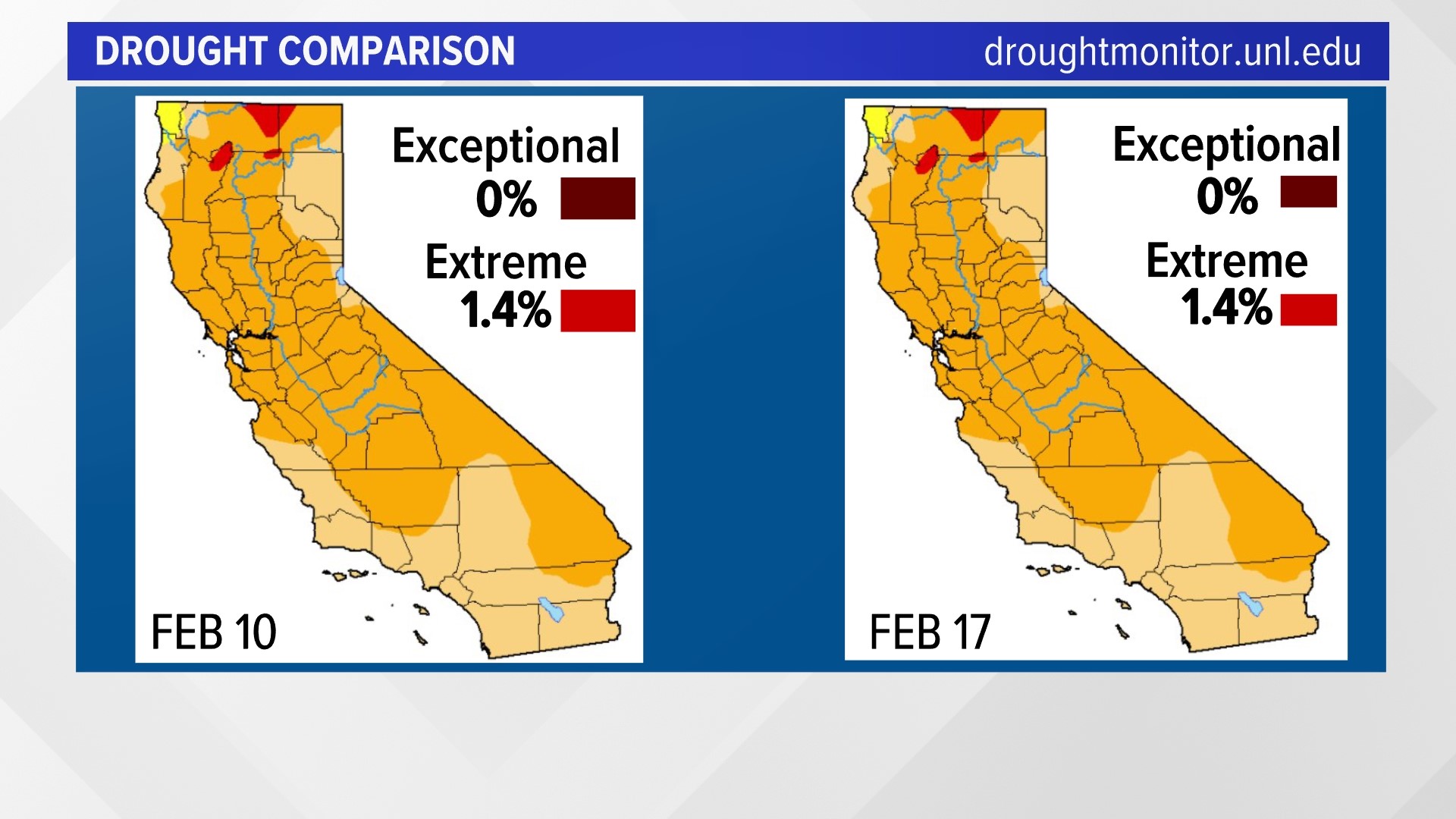
SACRAMENTO, Calif. — Another week was recorded with no changes to the U.S. Drought Monitor in California. This comes amid a nearly record dry stretch in the Sacramento and San Joaquin Valleys, and a record dry stretch of no measurable snow for the University of California Berkeley Central Sierra Snow Lab at Soda Springs.
Sacramento is approaching a nearly 50-year-old record for the longest stretch of dry weather. The current record for Downtown Sacramento is 44 days set back in 1976. The city is just days away from breaking that record, building on a dry streak starting Jan. 8.
The Central Sierra Snow Lab hit a record 37 days without snow from Jan. 8 through Feb. 14. That streak ended early Feb. 15 when light snow fell in the Sierra, only to return to dry, breezy weather by the afternoon.
Yet for weeks now, the U.S. Drought Monitor has remained steady.
Dan McEvoy, the regional climatologist with the Western Regional Climate Center and Desert Research Institute, says the historic wet storms in October and December are carrying us through this dry spell right now.
He says that California is at that turning point and hasn't completely seen what the full winter season will bring for rain and snow.
He says, if it stays dry for another couple weeks or month, we'll start to see some changes to more severe categories in the U.S. Drought Monitor maps.
A big input for the maps in the West depends on snowpack. McEvoy says once California gets past March and the peak snowpack we'll likely start to see those bigger changes back into extreme and exceptional categories.
WATCH ALSO: