YOUR STORIES: Want to share pictures from this weekend's storm with CBS 8? E-mail us!
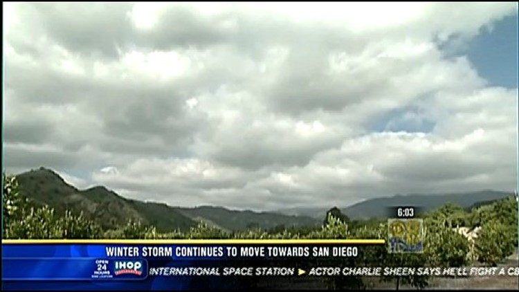
SAN DIEGO (CNS) - A blustery storm system will drop the local snow level to unusually low altitudes and get the weekend off to a decidedly frigid start for San Diego County residents, forecasters said Friday.
A deep trough of low pressure and a wet, extra cold front will put a windy winter chill on the region late Friday night and early Saturday, according to the National Weather Service.
Precipitation amounts are expected to reach up to 1.5 inches along the coast, as much as 3.5 inches in the mountains and one-quarter of an inch to 1 inch in the deserts, the NWS reported.
Low nighttime temperatures Saturday could dip into the mid-30s in ocean-front communities, the low 30s in the valleys, low 20s in the East County highlands and mid-30s in the deserts, according to meteorologists.
The storm, which may include some lightning shows, is headed to the region from the Seattle area, along with some stiff winds and temperatures 20 to 25 degrees below average for this time of year. It should reach Orange County around midnight and spread into the San Diego region over the early-morning hours Saturday, forecasters said.
A winter storm watch for the mountains is scheduled to be in effect from Friday night through Saturday night.
The Weather Service expects 6 to 12 inches of snow above 3,500 feet and around 20 inches above 5,500 feet. The frozen white flakes will drop to around 2,000-2,500 feet by Saturday night, and may reach some locations around the 1,000-foot mark, according to the NWS.
"With such low snow levels possible, this weather could be deadly for unprepared campers or hikers," the agency warned.
Along the coast, winds will range from 15 to 35 mph from midnight to 10 p.m. Saturday, potentially making driving hazardous in some locales, and strong rip currents will pose severe dangers for swimmers throughout the day Saturday, according the NWS.
A flash-flood watch, meanwhile, is scheduled for late Friday night into Saturday.
For those who live or own property in flood-prone areas, the San Diego Fire-Rescue Department is offering a limited number of free sandbags. The empty sacks -- recipients must obtain sand themselves -- may be picked up at the following city facilities:
-- Fire Station 15, 4711 Voltaire St., Ocean Beach;
-- Fire Station 20, 3305 Kemper St., Midway area;
-- Fire Station 21, 750 Grand Ave., Pacific Beach;
-- Fire Station 28, 3880 Kearny Villa Road, Kearny Mesa;
-- Fire Station 33, 16966 Bernardo Center Drive, Rancho Bernardo;
-- Fire Station 37, 11640 Spring Canyon Road, Scripps Ranch;
-- Fire Station 39, 4949 La Cuenta Drive, Tierrasanta;
-- Fire Station 40, 13393 Salmon River Road, Rancho Penasquitos;
-- Fire Station 46, 14456 Lazanja Drive, Santa Luz;
-- Fire Station 47, 6041 Edgewood Bend Court Pacific Highlands; and
-- lifeguard stations in La Jolla Shores, Mission Beach, Ocean Beach and Pacific Beach.
There is a limit of 10 sandbags per household or business. People are welcome to use beach sand to fill them, according to city officials.