
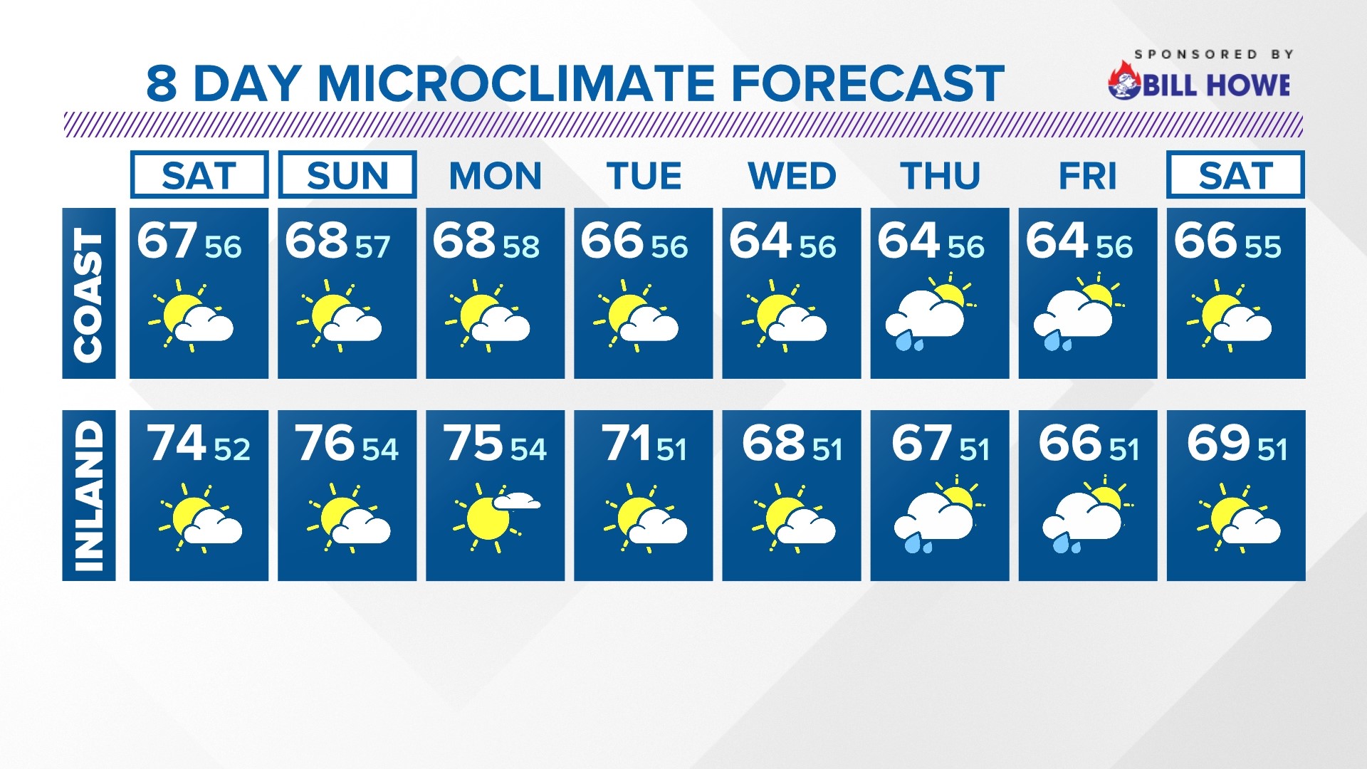
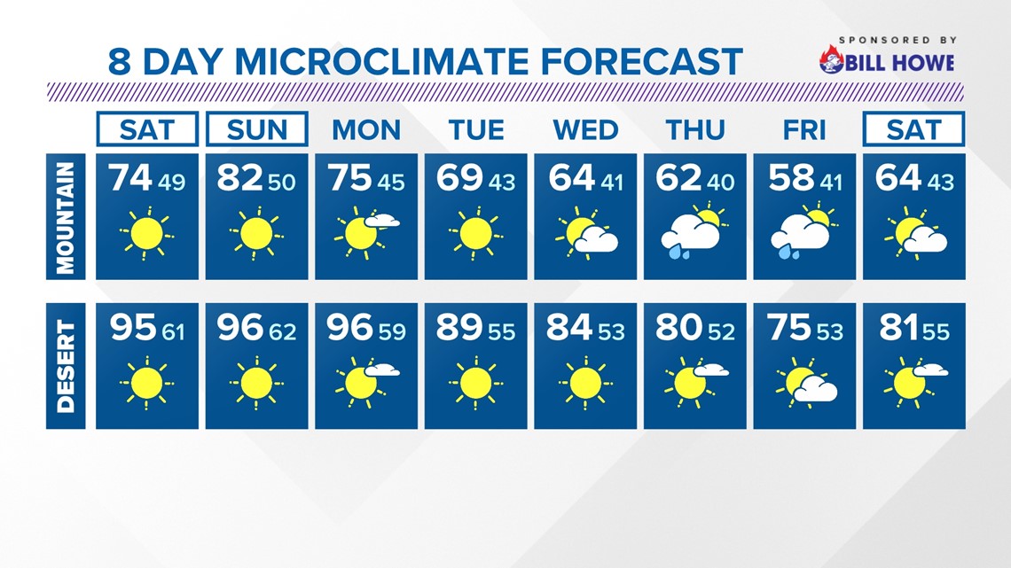
SAN DIEGO — A weak disturbance weakened a ridge of high pressure over the region. This led to a deepening of the marine layer with coastal low clouds and patchy inland fog. This atmospheric setup also led to slightly cooler daytime highs with widespread 60s to wrap up the work week.
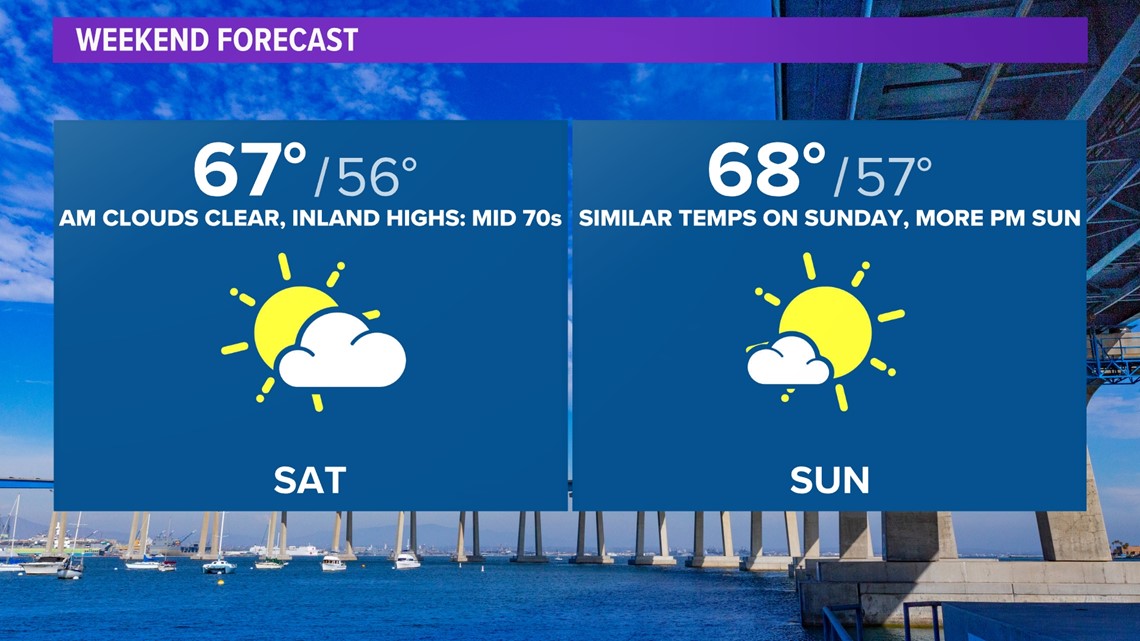
For the rest of the night, the marine layer clouds will roll in again through Saturday morning. Expect a mostly sunny sky to take over by the afternoon hours. At the same time, the weak ridge of high pressure will be moving in behind the previously mentioned disturbance. This will lead to a more shallow marine layer, low clouds favoring coast and metro cities, on Sunday with a mostly sunny afternoon and slight warm up for Sunday.

AT THE COAST:
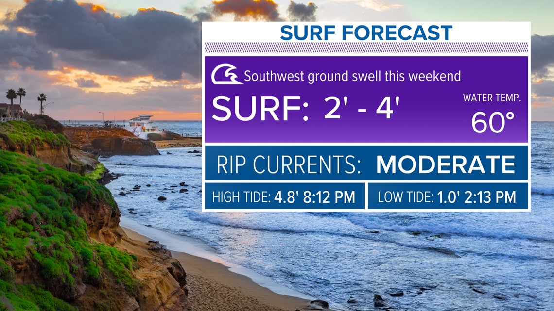
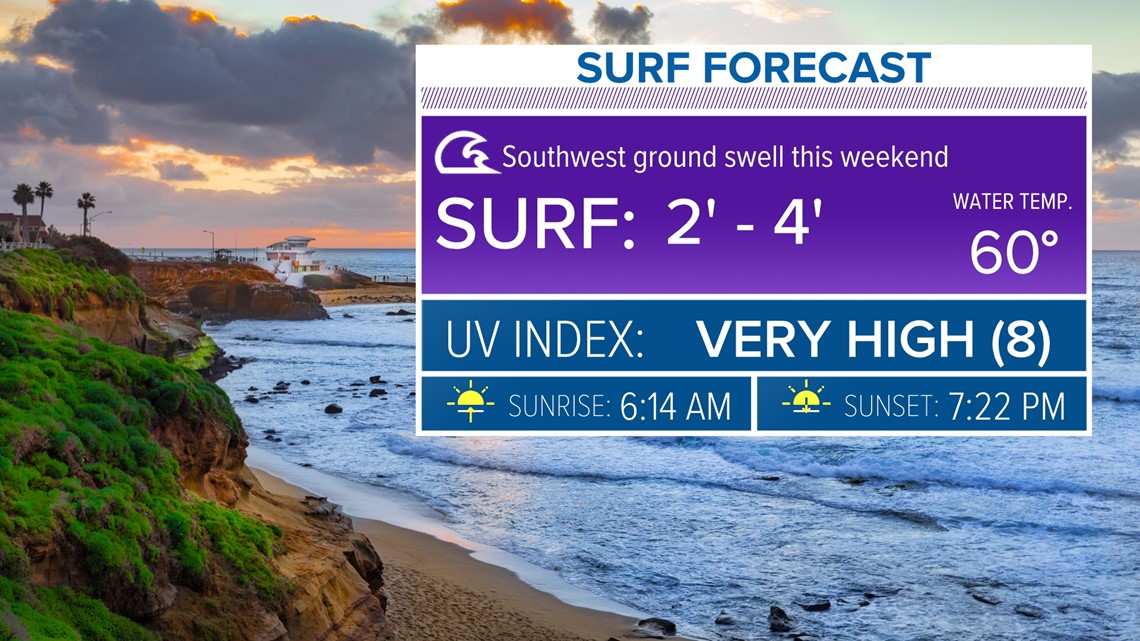
Our recent high surf subsided on Friday. Expect the surf to be 2 to 4 feet with a moderate risk of rip currents through Sunday.


By next week, a series of low pressure systems will sweep through the West. This will lead to more passing clouds and the return of cooler than usual temperatures by the middle of next week.
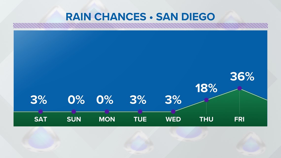
One of those lows will close in on Southern California. This could lead to a chance for scattered showers Thursday and Friday, along and west of the mountains. It's too early for more details. Those will be supplied in the days ahead.

Stay current on the microclimate forecast by downloading the CBS 8 app on your cell phone and the CBS 8+ app on Roku and Amazon Fire TV. There you’ll find all our newscasts, specials, the latest weather forecasts, breaking news, and much more.


HERE ARE MORE WAYS TO GET CBS 8:
ADD THE CBS8+ APP TO YOUR STREAMING DEVICE Roku | Amazon Fire