

SAN DIEGO — A chilly spring storm that has soaked the San Diego area with lots of rain and frosted its highland peaks with ice and snow since last weekend turned up the dial on the downpours today prior to its expected departure from the region Friday night.
Over a 20-hour period ending at midday, the wintry atmospheric system dropped an additional two to three inches of moisture in parts of the already saturated county, including Carlsbad, Escondido and San Marcos, according to the National Weather Service.
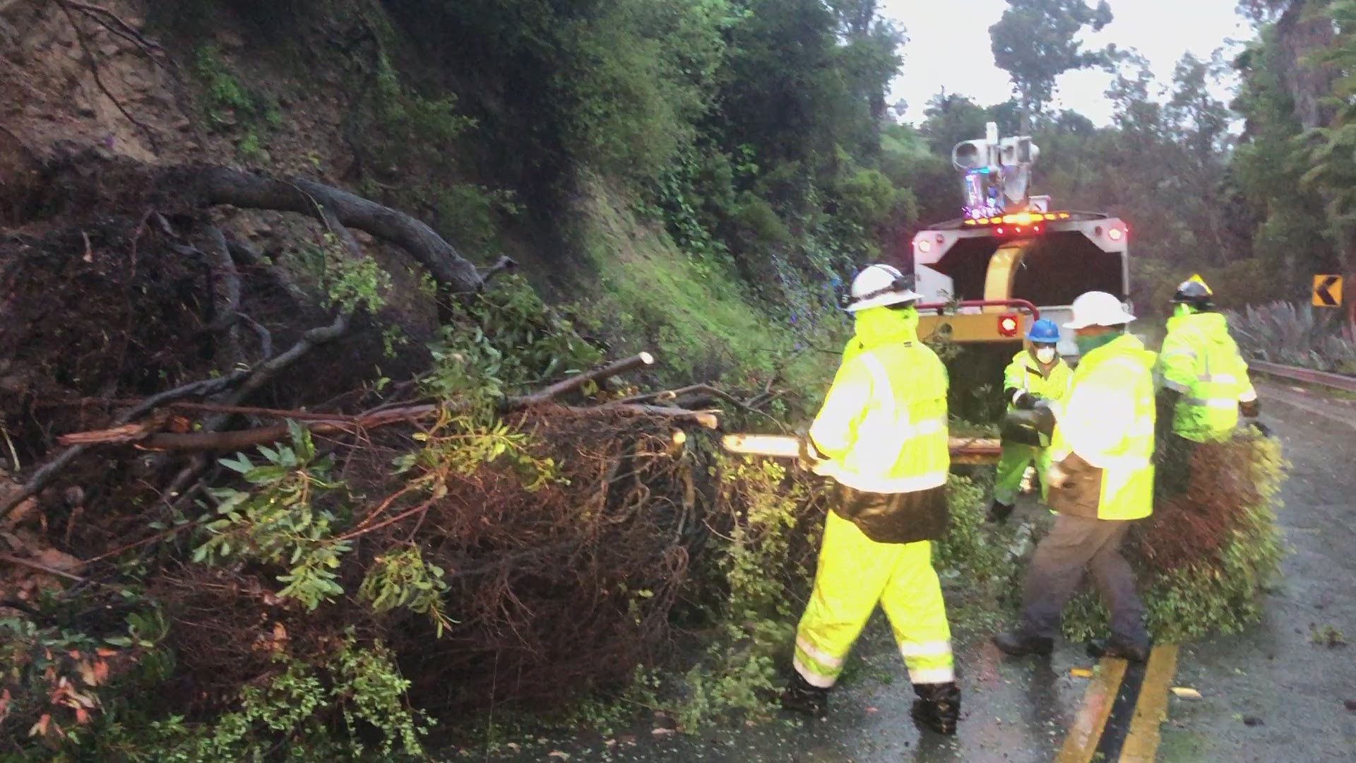
The persistent heavy showers led over the morning and afternoon to submerged and debris-blocked roadways in numerous communities.
Amid the intense cloudbursts, emergency crews had to rescue people in several locales, including the 1000 block of North Avenue in Deer Springs, where a car got stuck on the flooded roadway; an inundated motel in the 2400 block of Hotel Circle Place in Mission Valley; and in the 9400 block of Friars Road in Mission Valley, where a woman and her two dogs got stranded by floodwaters near a field once used for practice by the San Diego Chargers.
By late afternoon, the slow-moving weeklong storm had doused most parts of the county with at least several inches of rain or snow, and some with well over six inches' worth, according to meteorologists.
Five-day rain tallies as of 3:30 p.m. included: 8.35 inches in the Palomar area; 7.63 in Deer Springs; 7.12 in Lower Oat Flats; 7.01 in Horsethief Canyon; 6.8 in Couser Canyon; 6.27 in Valley Center; 6.26 in Bonsall; 6.14 in Carlsbad; 6.1 in Skyline Ranch; 5.88 in San Marcos; 5.86 in Encinitas; 5.68 at Henshaw Dam and in Oceanside; 5.65 on Mount Woodson; 5.62 in Fallbrook; 5.61 at Miramar Lake; 5.54 on Otay Mountain; 5.38 in Poway; 5.37 at Lake Wohlford; 5.31 in Rincon Springs; 5.28 in Mesa Grande; 5.23 in Escondido; 5.2 in Rancho Bernardo; and 5.17 in Santee.
Among other local rainfall totals since Sunday were 4.57 inches in San Onofre; 4.55 in Mission Valley; 4.52 in La Mesa and Miramar; 4.44 in Kearny Mesa; 4.41 in Fallbrook; 3.53 at Lindbergh Field; 4.05 in Granite Hills; 3.86 in Ramona; 3.83 in Flinn Springs; 3.53 in Serra Mesa; 3.45 in Point Loma; 3.34 in Barona; 3.19 at Dulzura Summit and in San Diego Country Estates; 3.09 in Harbison Canyon; 2.9 in Alpine; 2.64 at Brown Field airport in Otay Mesa; 2.28 in Thousand Trails; 2.2 in Ranchita; 1.68 in Campo; 1.38 in Tierra Del Sol; 1.14 in San Felipe; 0.79 in Borrego Springs; 0.77 in Agua Caliente; and 0.76 in Ocotillo Wells.
In the unseasonably frigid East County highlands, the bands of dark clouds shed snowfalls that built up accumulations of 14 inches on Birch Hill, seven inches on Palomar Mountain and four inches on Mount Laguna, according to the weather service.
When the stubborn storm finally makes its exit overnight, partly cloudy and more temperate conditions will develop on Saturday, though lingering moisture from the north will keep a fair amount of clouds around along with a small chance of showers Sunday and Monday, forecasters advised.
Fair skies and warmer temperatures are expected by the middle of next week, according to meteorologists.