SAN DIEGO — A chilly spring storm that moved over the San Diego area last weekend continued dousing the county with intermittent rainfall today and added some mountain snow to the wintry mix.
The cold and wet spell, which is expected to linger until the end of the workweek, has delivered widely varying amounts of local moisture since Sunday, ranging from around a half-inch in some areas to 10 times that amount in others, the National Weather Service reported.
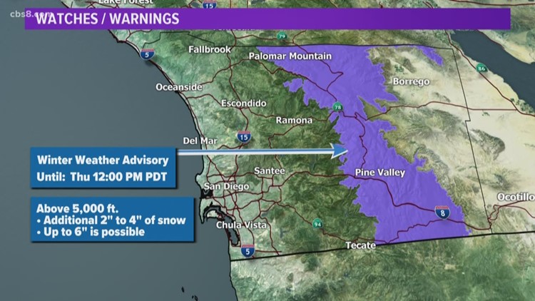
The storm had laid down some modest layers of snow in parts of the East County highlands as of Wednesday afternoon, including 5 inches' worth on Palomar Mountain and 3.5 inches on Birch Hill, according to the weather service.
Other four-day precipitation totals at 3:45 p.m. include 3.61 inches of rain in Lower Oat Flats, 3.26 in Deer Springs, 3.01 on Mount Woodson, 2.97 in Valley Center, 2.41 in Santee, 2.4 in San Marcos, 2.39 in Carlsbad, 2.35 in La Mesa, 2.21 in Poway, 2.05 in Encinitas, 2.04 in Escondido, 1.92 in Fallbrook, 1.84 in Oceanside, 1.83 in Kearny Mesa, 1.8 in Mission Valley, 1.67 in Rancho Bernardo, 1.64 in Point Loma, 1.39 in Pine Valley, 1.38 at Lindbergh Field, 0.61 in Ocotillo Wells, 0.52 in Borrego Springs and 0.45 in Agua Caliente.
Due to the potential for periodic heavy downpours, a flash flood watch was scheduled to be in effect countywide until 7 p.m.
The slow-moving storm system should exit the region to the east on Saturday, clearing the way for dry conditions with warmer temperatures through at least early next week, the weather service advised.