
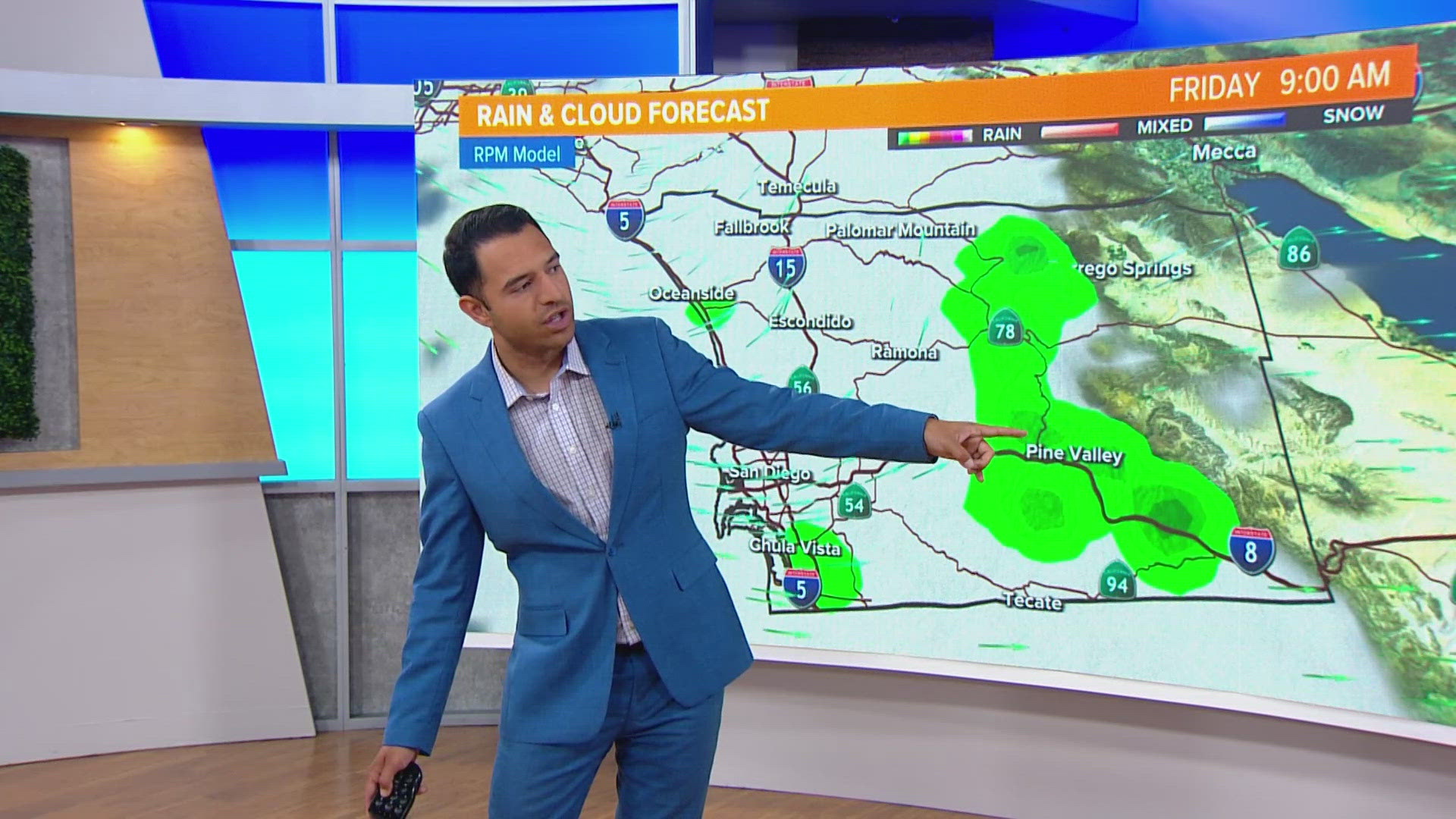
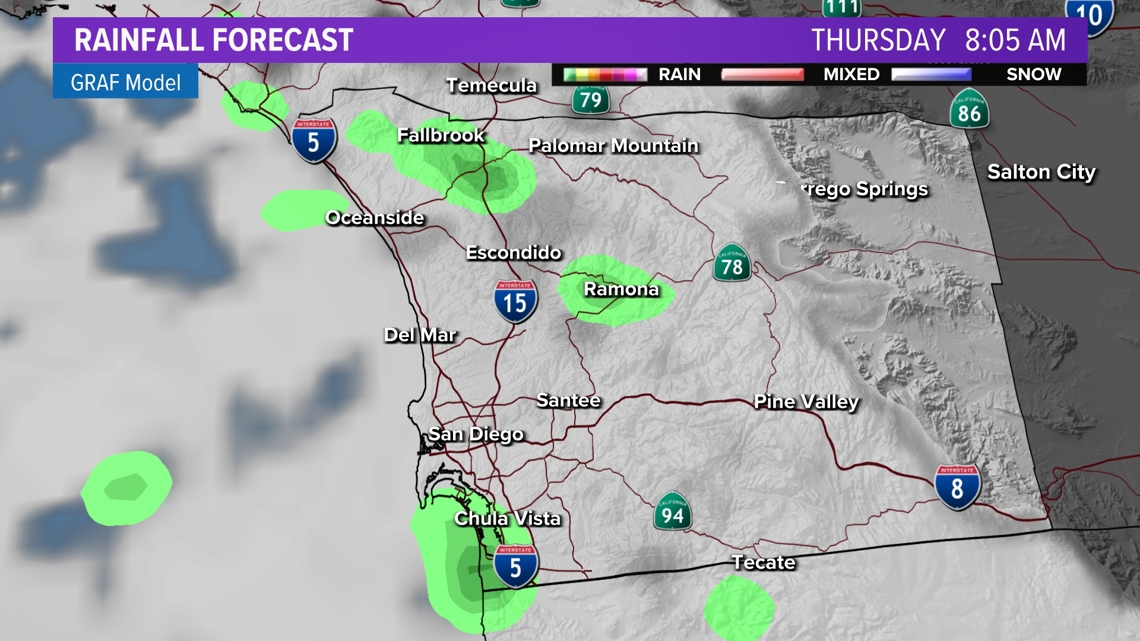
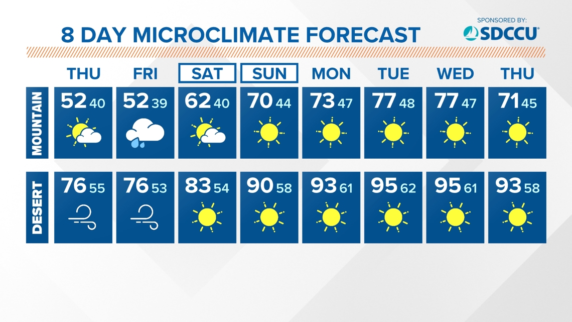
SAN DIEGO — A low pressure system continues to push through the region, bringing a slight chance of showers from the coast to the mountains. There's very little indication that this will be a major rain-maker. The most favorable time frame looks to be tonight through Thursday morning, and again Thursday night through Friday with another low closing in on the region. The main hazard will be slick roads rather than flooding.

Radar | Interactive Map
The accumulations will be light, mainly a few hundredths of an inch, on both days. The coastal mountain slopes could see up to 0.25" overall for both days. We look to dry out into the start of the weekend with a slight chance of showers on Saturday morning before afternoon sunshine.

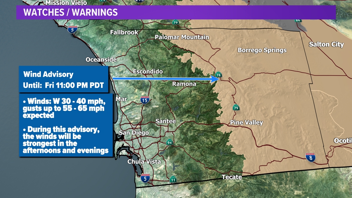
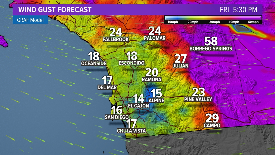
Onshore winds will pick up as these system pass through the West. A Wind Advisory is in effect for San Diego County mountains and desert through Friday night. The winds will be strongest during the late afternoon and early evening hours Wednesday through Friday. Expect westerly winds in the 30s and 40s with gusts peaking 55 - 65 mph.


A cool weather pattern is setup over Southern California this week as a couple of low pressure systems sweep through the region. This will intensify onshore flow which will make for a deeper marine layer. This means the beaches will be hard pressed to entirely clear out through the week. Temperatures will be 4 to 7 degrees below our seasonal average for the coast and inland.
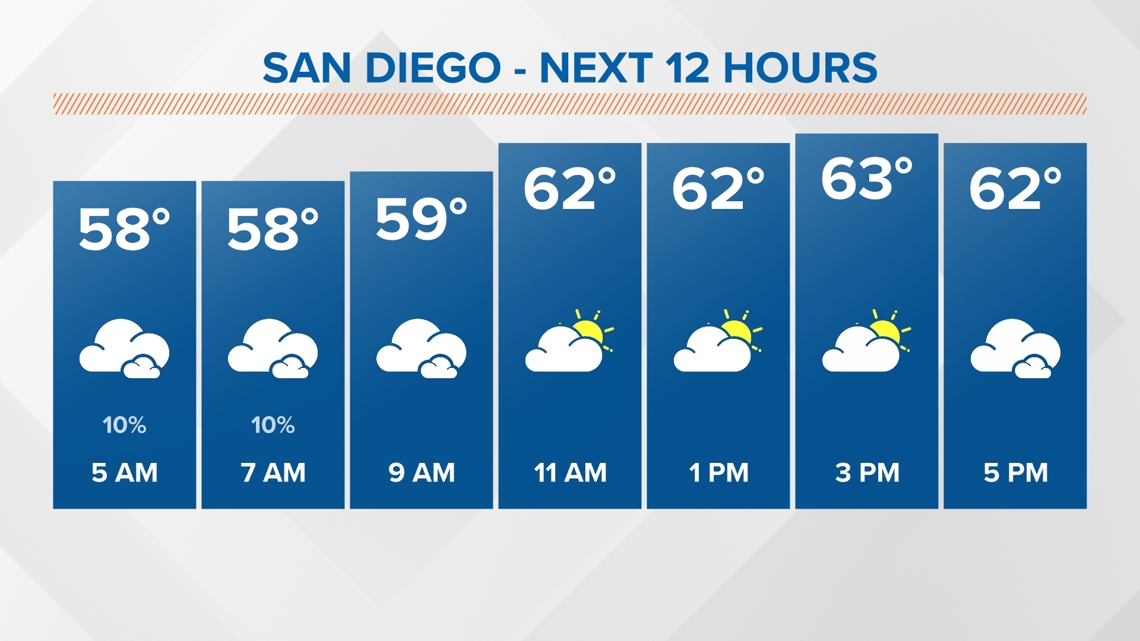
THURSDAY TEMPERATURES:

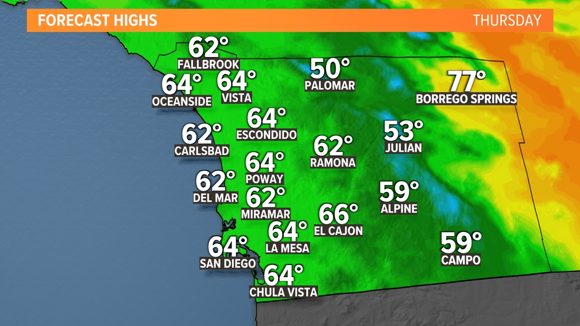
AT THE COAST:
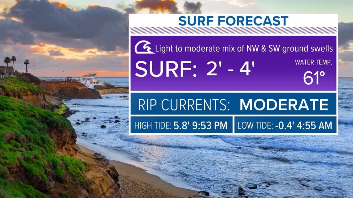
Surf has shifted back to a spring pattern. Expect the surf to be 2 to 4 feet with a moderate risk of rip currents through Thursday. Surf heights will increase to 3 to 5 feet with a high risk of rip currents on Friday.

Stay current on the microclimate forecast by downloading the CBS 8 app on your cell phone and the CBS 8+ app on Roku and Amazon Fire TV. There you’ll find all our newscasts, specials, the latest weather forecasts, breaking news, and much more.


HERE ARE MORE WAYS TO GET CBS 8:
ADD THE CBS8+ APP TO YOUR STREAMING DEVICE Roku | Amazon Fire