SAN DIEGO (CBS 8) - How much did the recent series of rain storms in California contribute to lessening the state's drought conditions?
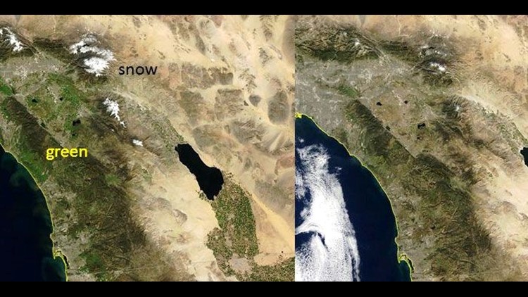
The National Weather Service office in San Diego tweeted a satellite photo showing California finally "greening up".
NWS San Diego also tweeted changes at Lake Hodges. A 2014 photo shows an area of the lake completely dry. A March 1, 2017 comparison photo shows the lake filled with water.
Check out the following image from U.S. Drought Monitor of recent drought conditions in the western half of the U.S. compared to a year ago. Most of Southern California was under the "Extreme Drought" to "Exceptional Drought" category. The recent rain storms this year brought conditions down to "Abnormally Dry".

The U.S. Drought Monitor is jointly produced by the National Drought Mitigation Center at the University of Nebraska-Lincoln, the United States Department of Agriculture, and the National Oceanic and Atmospheric Administration. Map courtesy of NDMC-UNL.
What does this mean for Californians? Can we start taking 30 minute showers again? Probably not.
From the California Department of Water Resources:
Although this year may be wet, dry conditions could return again next year. 2017 may be only a wet outlier in an otherwise dry extended period. Unfortunately, the scientific ability to determine if next year will be wet or dry (known as sub-seasonal to seasonal forecasting, or long-range weather forecasting) isn’t yet capable of delivering reliable predictions.
RELATED COVERAGE