
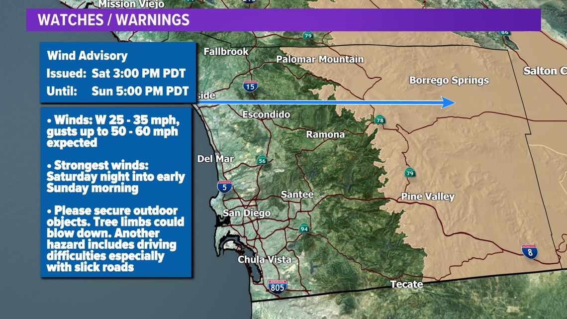
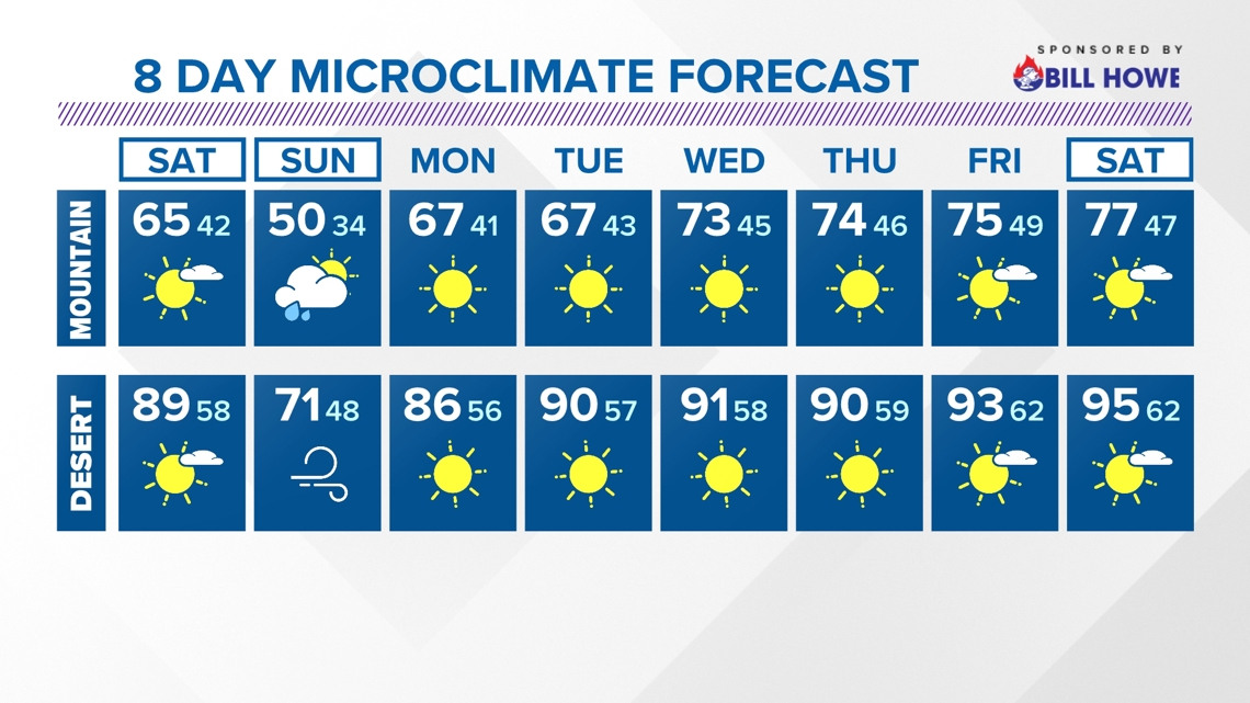
SAN DIEGO — The marine layer will deepen over the weekend as a low pressure system closes in over the Great Basin. Our winds will start to pick up Saturday afternoon with the strongest winds slated for Saturday night through Sunday morning. A Wind Advisory has been issued for San Diego County mountains and desert starting Saturday afternoon. Expect sustained wind speeds in the 20s and 30s with gusts peaking in the 50s and 60s.
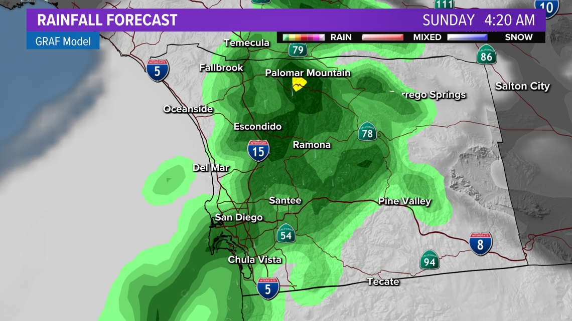
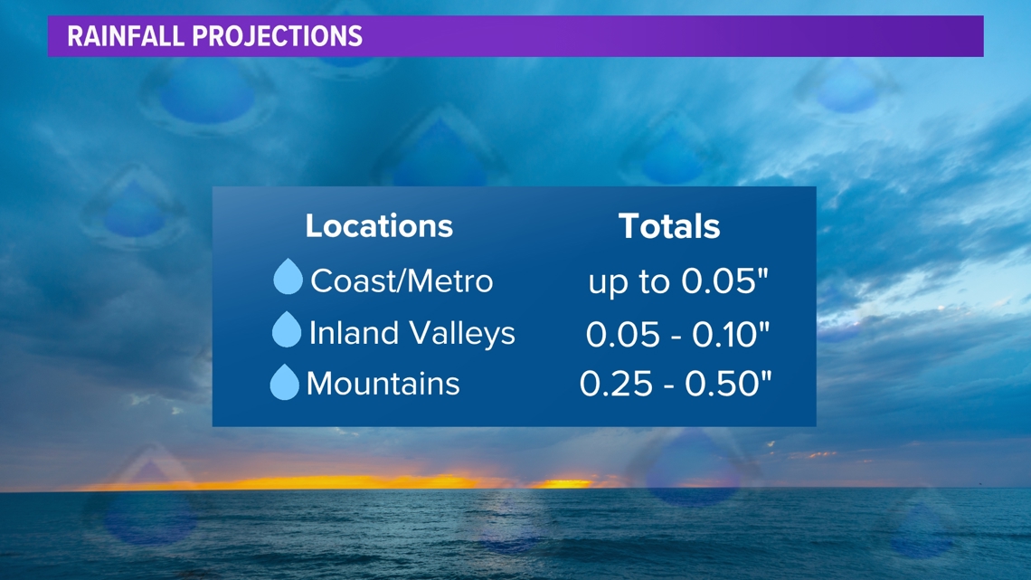
This fast-moving storm system will also increase our chances for wet weather. There is a chance for scattered showers along and west of the mountains. The window for showers will be Saturday night through Sunday morning with the most active period being from late Saturday night through Sunday morning. Rain estimates will be relatively light. The main hazard will be slick roads. Drier conditions are expected Sunday afternoon.


AT THE COAST:
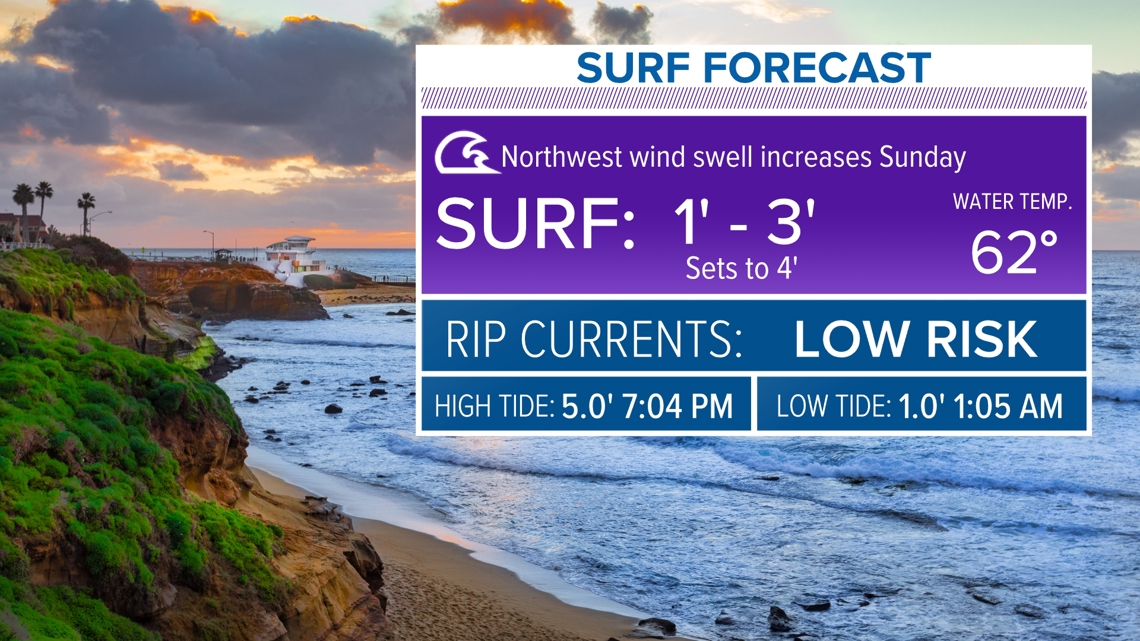
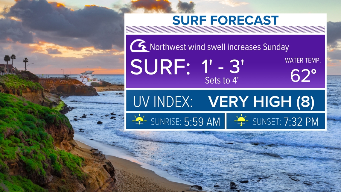
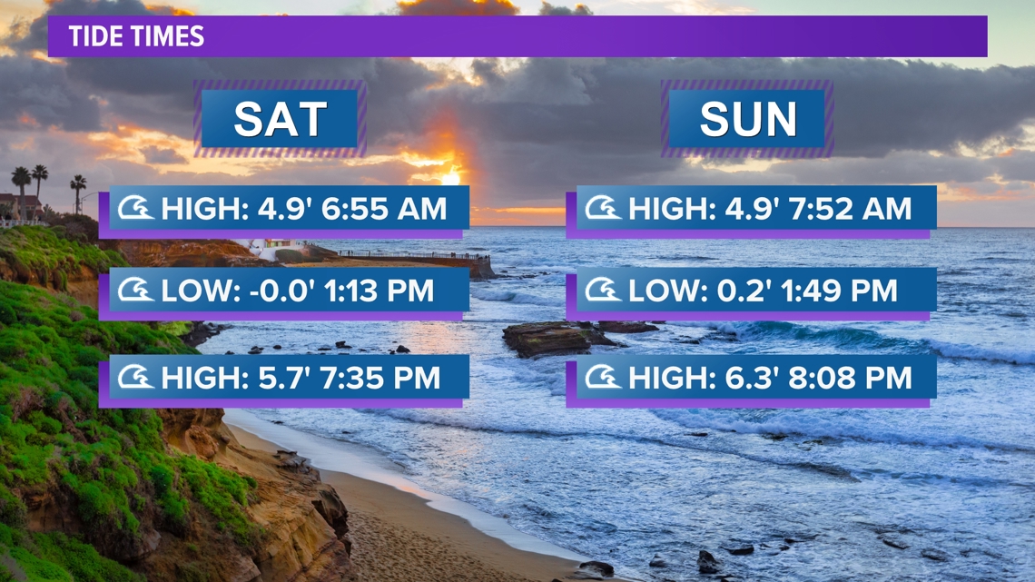
Surf heights will be 1 to 3 feet with sets to 4 feet and a moderate risk of rip currents.
By Sunday, surf heights will be elevated to 3 to 5 feet with sets to 6 feet. There will also be a high risk of rip currents.


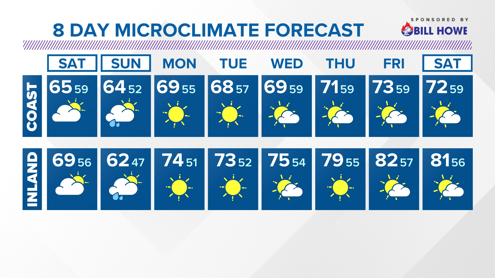
Over the weekend, temperatures will drop due to the intrusion of cold air from this storm system. The dip will be subtle closer to the coast, but inland temperatures will drop 10 to 20 degrees below seasonal on Sunday.
By the start of next week, expect drier and warmer conditions as the system moves on out. It looks to be a mostly sunny Monday with a recovery in temperatures. The marine layer will gradually make a come back with night and morning low clouds and afternoon sunshine to follow for much of next week.
Stay current on the microclimate forecast by downloading the CBS 8 app on your cell phone and the CBS 8+ app on Roku and Amazon Fire TV. There you’ll find all our newscasts, specials, the latest weather forecasts, breaking news, and much more.


HERE ARE MORE WAYS TO GET CBS 8:
ADD THE CBS8+ APP TO YOUR STREAMING DEVICE Roku | Amazon Fire