
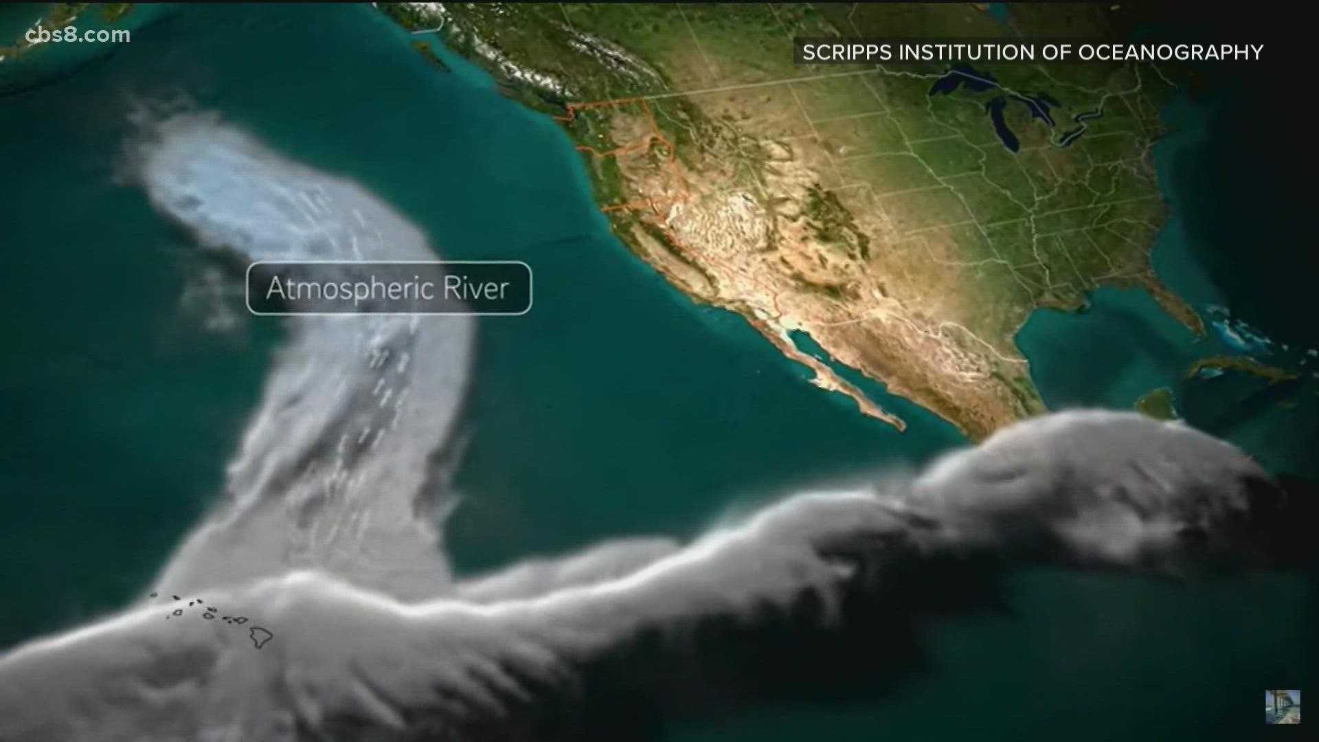
SAN DIEGO — Atmospheric rivers [AR] are a major contributor to the annual precipitation on the West Coast. In fact, they make up half of the yearly totals. And when you are talking about these long, narrow bands of water vapor that can hold as much as 25 Mississippi Rivers and contribute to major flooding across the West Coast, more detailed data is better.
Researchers are improving technology and flight paths to better understand these rivers in the sky one AR at a time.
"The major operational goal is to improve the forecast of these extreme storms at a lead time of zero to three days. By zero days, I mean within the next 12 hours or so," said Dr. Anna Wilson, the Field Research Manager from The Center for Western Weather and Water Extremes. She also oversees the AR Recon Program led by Scripps Institution of Oceanography at UC San Diego.
You may have heard of recon missions more closely associated with Hurricane Hunters. These less turbulent AR flights are different.
"For an Atmospheric River, we are flying over top of the entire system. In the hurricanes, they're often in the hurricane. They're not necessarily over top of it. You see amazing pictures of the Hurricane Hunters when they are in the eye and you can see up above them," continued Dr. Wilson.
Recent advancements have been made to better understand the impacts of heavy rain and high winds. The new missions will design flight tracks for each individual Atmospheric Rivers rather than track the same area over the region in the Pacific.
The recon missions fly above the swath of moisture. This has made satellites a helpful forecasting tool. But, that was only scratching the surface.
Using technology like dropsondes, the weather device can collect data like temperature, moisture, wind, and pressure through the thick clouds of an AR, at nearly four times a second, after being released from the recon plane until it hits the ocean.
"So that's why we are using these observations that can transit through those clouds and make observations. So that in combination with all the amazing satellite observations, we can get a really good picture of what's going on over the Northeast Pacific," stated Dr. Wilson.
On average, the C130s drop 25 and the NOAA aircraft drop about 30. But, up to 80 dropsondes can be released during a recon mission.
As the saying goes, what goes up must come down. In this case, not only is it a helpful forecasting tool, but it is environmentally safe as well.
The dropsondes are mostly biodegradable from the parachute to their circuit board components. They sink quickly and are covered by the ocean floor within a matter of weeks.
"We're trying to gather information to improve forecasts, taking care of people, the economy, the West Coast, ecosystems, all those sort of things, so we don't want to be throwing litter into the ocean," said Dr. Wilson.
WATCH RELATED: Atmospheric rivers helping San Diego rainy season (Jan 2022):