
SAN DIEGO — The first full day of spring arrived in decidedly wintry fashion in the San Diego area, with a blustery, season-straddling storm continuing Wednesday with scattered rain, winds and potential for more mountain snow.
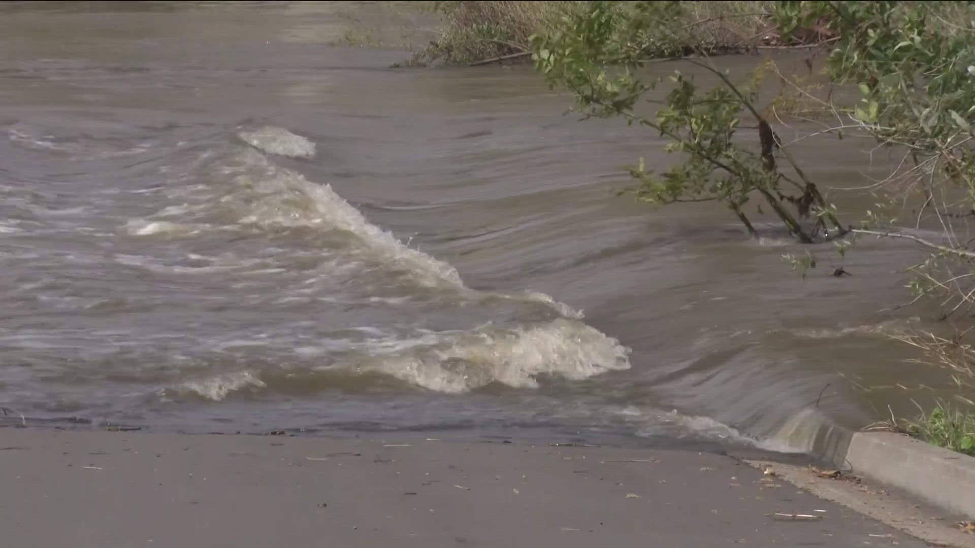
The atmospheric river is now weakening, wind speeds are dying down and on the back end of the storm. Many places are still flooded from Tuesday, including the farmlands near the Tijuana river and in Mission Valley, a place prone to flooding.
As of early Tuesday afternoon, the unsettled atmospheric system had generated two-day precipitation tallies of more than 1 1/2 inches along the coast, over 2 inches in the inland valleys, well over 3 inches in the East County highlands and up to four-fifths of an inch in the deserts, according to the National Weather Service.
Though meteorologists recorded no new local snowfall Tuesday morning or afternoon, up to about a foot of frozen white flakes was expected to fall overnight in the highest reaches of the county, including Mount Laguna and Palomar Mountain, forecasters reported.
A winter weather advisory was in effect until 5 a.m. Thursday for San Diego County mountain communities. The icy conditions and winds up to 60 mph will make traveling through those locales "very difficult to impossible," the NWS cautioned.
As of just before 2 p.m. Tuesday, the local 48-hour precipitation totals included 3.61 inches on Palomar Mountain; 2.79 at Henshaw Dam; 2.63 in Mesa Grande; 2.47 on Birch Hill; 2.4 in Oak Grove; 2.18 in Pine Hills; 2.12 in Julian; 2.11 on Otay Mountain; 2.1 at Lake Cuyamaca; and 2.08 in Skyline Ranch.
Among other moisture tallies over the period were 1.78 inches at Lake Wohlford; 1.77 in Santa Ysabel; 1.72 on Volcan Mountain; 1.71 in Valley Center; 1.66 in Escondido; 1.65 on Mount Woodson; 1.64 in Descanso; 1.58 in Deer Springs; 1.57 in San Onofre; 1.45 in Encinitas; 1.44 in Oceanside; 1.43 in Ramona; 1.41 in Rancho Bernardo; 1.35 in Poway; 1.34 in Carlsbad; 1.32 in Miramar; 1.24 in San Marcos; 1.21 in Kearny Mesa and La Mesa; 1.19 in Carlsbad; 1.18 in Santee; 1.15 in Bonsall; 1.11 in National City; 1.08 at Montgomery Field; 1.06 in Vista; 1.05 in Flinn Springs; 0.99 in Granite Hills; 0.98 in Point Loma; 0.8 in Borrego Palm Canyon; 0.73 at Brown Field; 0.16 in Agua Caliente; and 0.12 in Ocotillo Wells.
Over a 24-hour span ending at 2:15 p.m. Tuesday, according to the weather service, the storm-driven winds had reached top speeds of 83 mph in the eastern highlands on Palomar Mountain; 58 mph in the inland valleys in the San Miguel area; 52 mph along the coast in Las Flores; and 35 mph in the desert at Borrego Valley Airport.
Periods of rain and mountain snow will continue across the San Diego area Wednesday, followed by cool, dry and breezy conditions Thursday through next weekend, according to the weather service.
Another low-pressure system from the northwest could bring more precipitation to the county next week, forecasters reported.
Road Closures
The City of San Diego released the following road closure information for Mission Valley area river-crossing roads. These roadways were closed at 9 p.m. Monday night:
• Camino De La Reina at Camino De La Siesta (westbound)
• Camino De La Reina west of Avenida Del Rio (eastbound)
• San Diego Mission Road between Fairmount and Caminito Yucatan (eastbound and westbound)
• Qualcomm Way, Rio San Diego Drive (southbound)
• Mission Center Road between Hazard Center Drive and Camino De La Reina (northbound)
• Ward Road at Camino Del Rio N (southbound)
• Camino Del Este between Station Village Drive and Camino De La Reina (northbound)
• Camino Del Este between Station Village Drive and Camino De La Reina (southbound)
Weather Alerts
Interactive Radar Map | Follow the rain as it moves into San Diego County
Flood Watch | Coast, Inland and Mountain areas:
March 21, 5 AM - March 22, 9 PM
Winter Weather Advisory | Mountain areas:
March 22, 4:38AM - March 23, 5:00 AM
High Surf Advisory | Coastal area:
March 22, 2 AM - March 23, 9 PM
Sand and Sandbags
San Diego County Office of Emergency Services and ReadySanDiego.org reports that free sand and sandbags are available to residents and business throughout San Diego County at the following locations:
Storm Preparedness & Resource Information
The Get it Done app can help you report blocked storm drains, potholes, and broken streetlights
Sign up for Alert San Diego notifications for all your telephone numbers
Report flooding to the City's emergency dispatch center at 619-527-7500
Report downed electrical lines or gas emergencies to San Diego Gas & Electric at 800-411-7343
ReadySanDiego.org has information on how to protect yourself and your property during a flooding situation
For more information on preparing for a storm and what to do during and after the rain, click here to be taken to the City of San Diego’s Storm Preparedness website.
Watch Related: San Diego hit with 12th atmospheric river | Downed trees, Mission Valley flooding (Mar 21, 2023)