
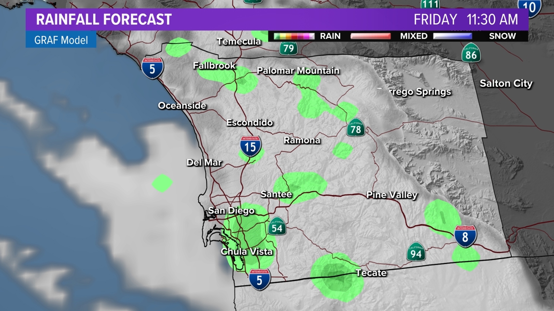
SAN DIEGO — A slight chance for showers continues on Friday across San Diego County with the heaviest accumulations expected along the foothills and the mountains. Clouds will also be abundant, but a few breaks in the clouds at times can be expected. Strong winds over mountain and desert locations will peak in the afternoon before declining Friday night into the weekend. The plus side to this unsettled weather the last few days is that the weekend shows generally drying conditions and warmer temperatures as it ensues.


A low pressure system pushed through the region Wednesday through Thursday. It brought gusty winds, reinforced cooler than usual temperatures and had spotty showers popping up in parts of the county. The accumulations were light, but another incoming low pressure system over the West will add to our recent totals by Friday. Expect chances for more showers with rain more favorable across the foothills. With this next round, the more favorable time frame for wet weather will be Friday morning and afternoon with isolated activity through early Saturday morning. The main hazard will remain slick roads rather than flooding.
Radar | Interactive Map
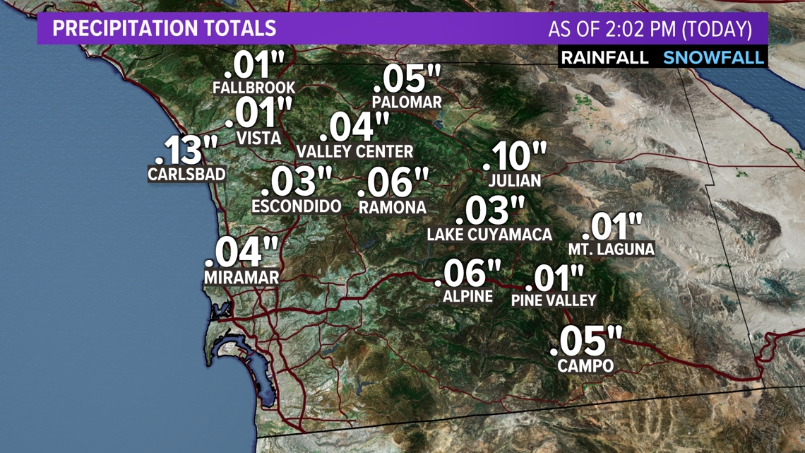
RECENT RAINFALL TOTALS:

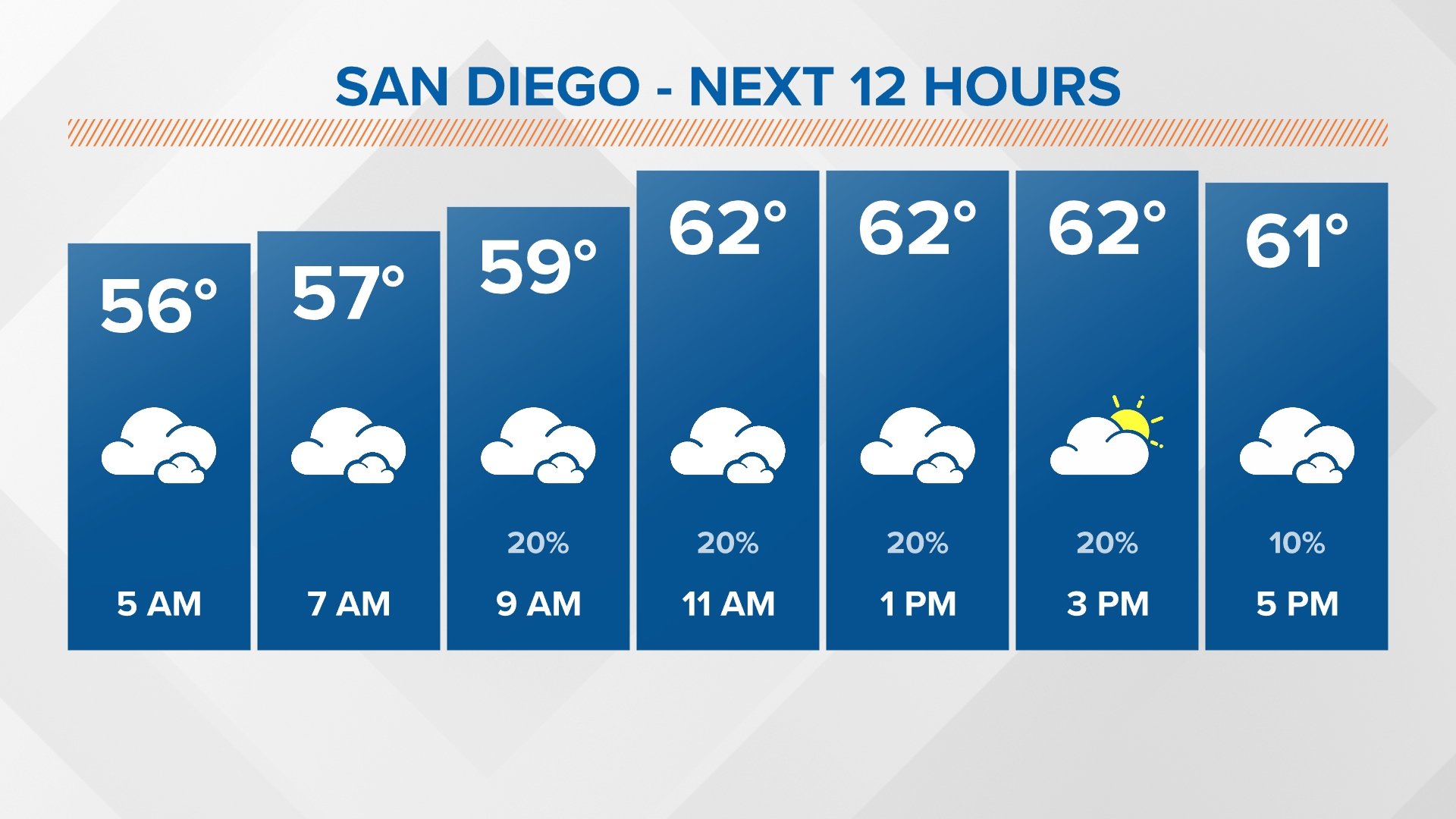
Any additional rain showers over the course of the morning on Friday (and even early Saturday) will continue to be rather light, only a few hundredths of an inch. Some models have pushed our inland valleys closer to a tenth and maybe even two tenths of an inch, though all models as of early Friday morning have been trending downward. We look to dry out into the start of the weekend with a shower or two possible on Saturday morning before afternoon sunshine, mainly inland.

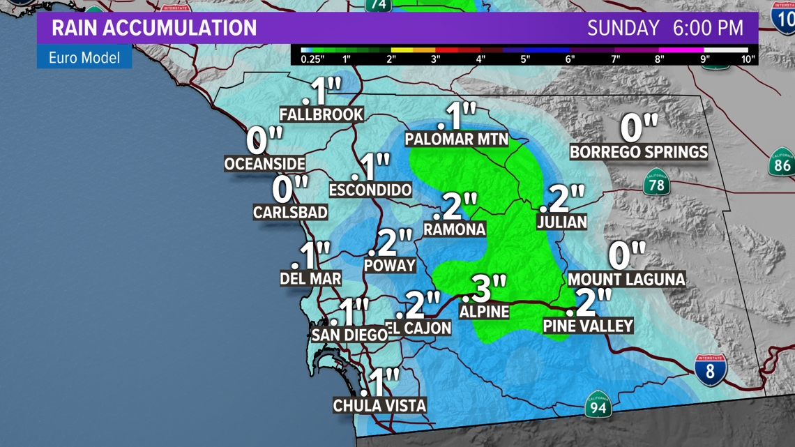
ADDITIONAL RAINFALL TOTALS:

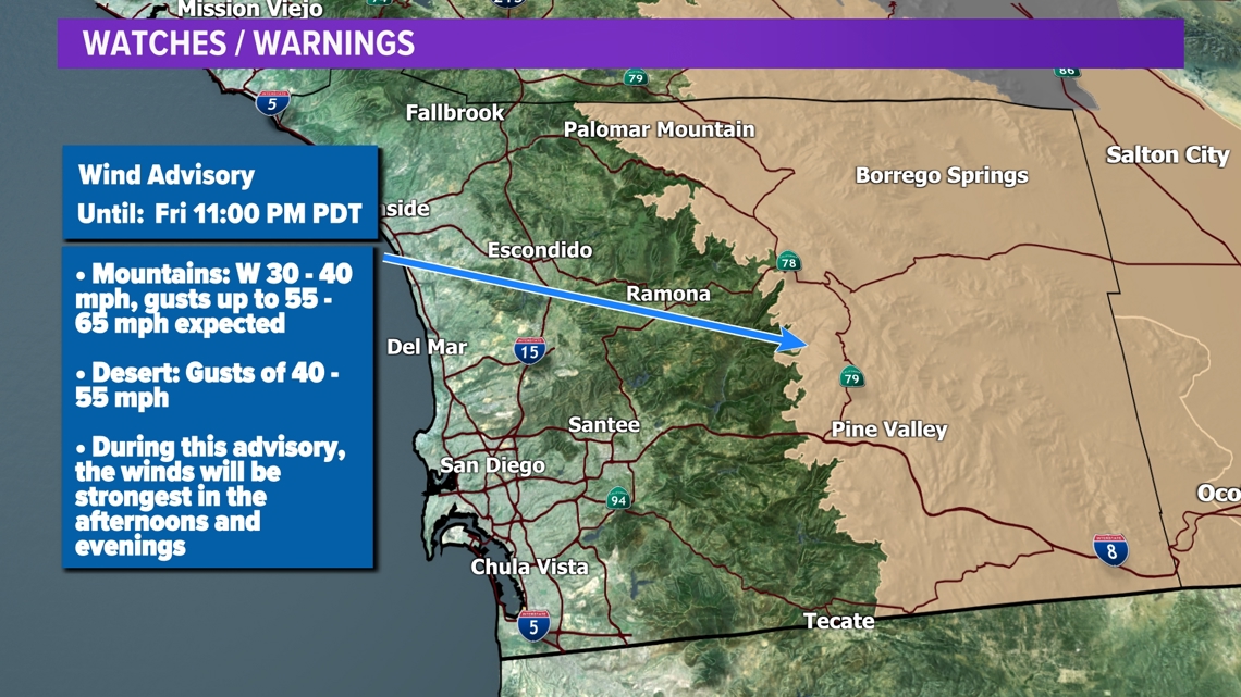
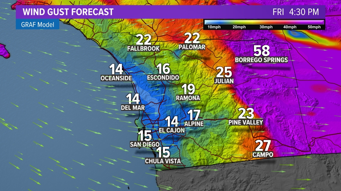
Onshore winds will remain intact through Friday as well. A Wind Advisory is still in effect for San Diego County mountains and desert through Friday night. The winds will be strongest during the late afternoon and early evening hours again on Friday. Expect westerly winds in the 30s and 40s with gusts peaking 55 - 65 mph.


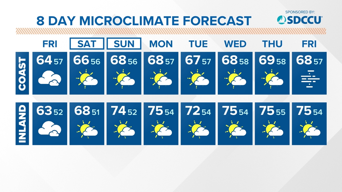
The cool weather pattern in Southern California is due to a couple of low pressure systems sweep through the region. This intensified onshore flow which will made for a deeper marine layer. This means the beaches will be hard pressed to entirely clear out through Friday. Temperatures will remain 4 to 10 degrees below our seasonal averages for the coast and inland.
FRIDAY TEMPERATURES:
AT THE COAST:
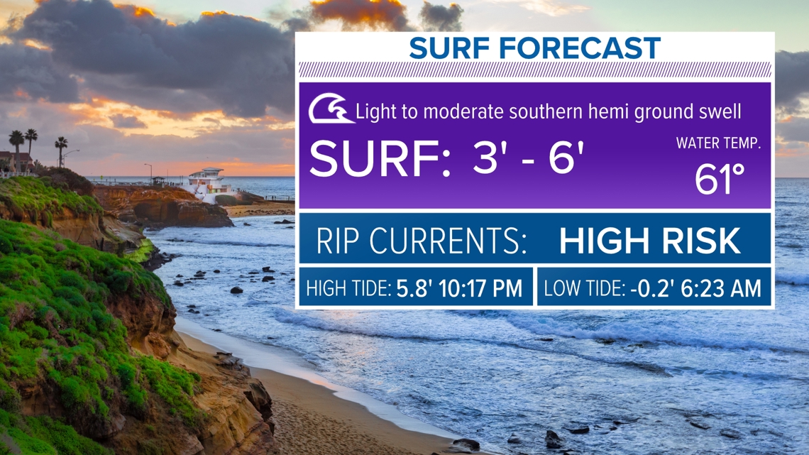
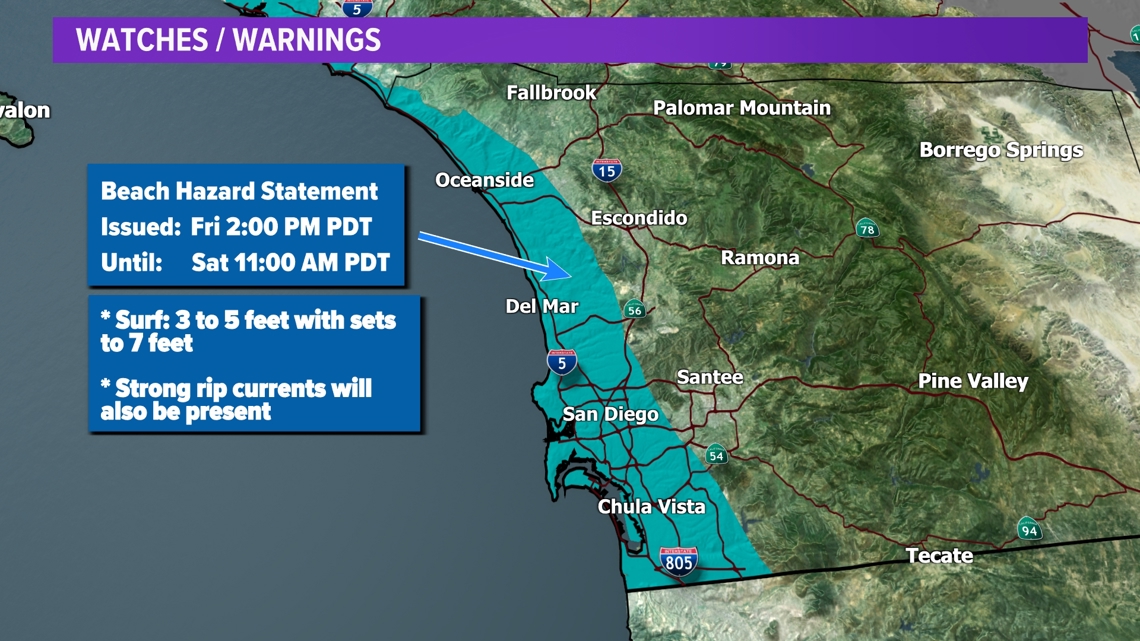
Surf heights have increased along our coastline and will stay elevated into the weekend. A Beach Hazard Statement will go into effect on Friday. If you are not a skilled swimmer, you are advised to stay out of the water during the duration of the beach alert.


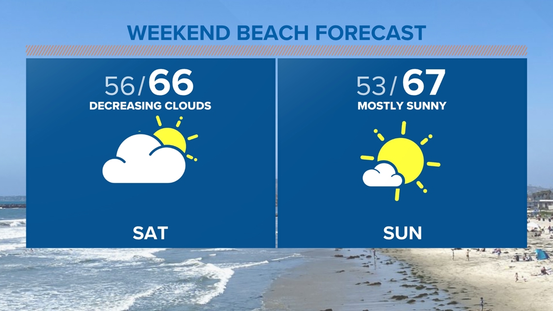
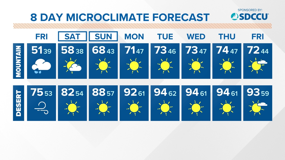
Over the weekend, we will dry out and see more afternoon sunshine. It will still be stubborn to completely clear at the coast next week with upper 60s dominating the forecast. Inland temperatures will be warming up to widespread 70s for the inland valleys and mountains. The recent cooler 70s in the desert will return to the 90s for much of next week.
Stay current on the microclimate forecast by downloading the CBS 8 app on your cell phone and the CBS 8+ app on Roku and Amazon Fire TV. There you’ll find all our newscasts, specials, the latest weather forecasts, breaking news, and much more.


HERE ARE MORE WAYS TO GET CBS 8:
ADD THE CBS8+ APP TO YOUR STREAMING DEVICE Roku | Amazon Fire