
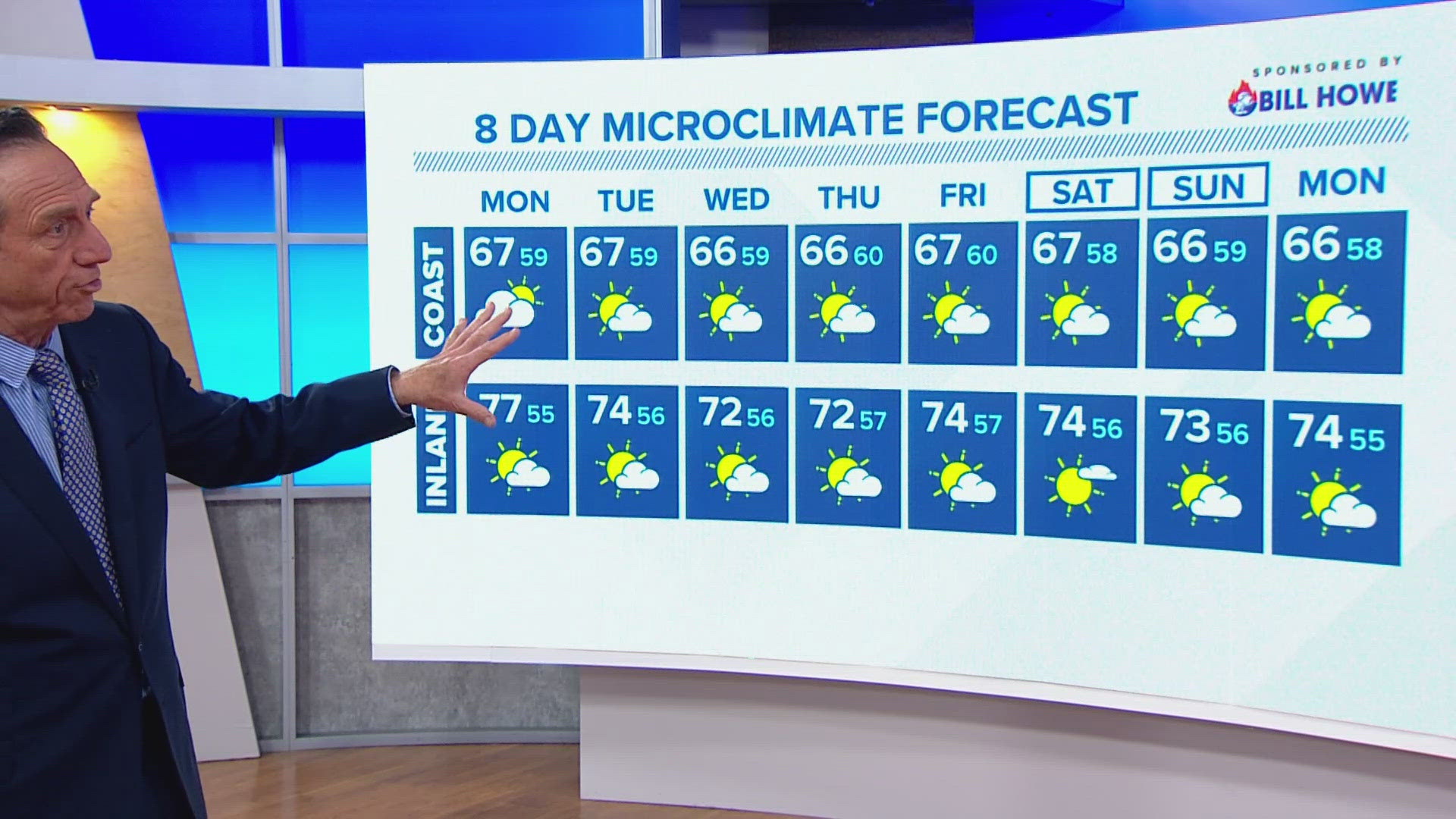
SAN DIEGO — We are in a spring weather pattern, meaning we have clouds through the night into the early mornings. Those low clouds will eventually give way to mostly sunny skies by the afternoon.
The start of the workweek will have a marine layer that appears to be slightly thinner. This means the inland microclimate will clear by mid to late morning.
The beaches and coastal regions might take a bit longer to clear of the "May gray" atmosphere.
The mountains and deserts will have plenty of sunshine.
SEASONAL (AVERAGE) DAYTIME HIGHS:
- Coast upper 60s
- Inland near to upper 70s
Stay current on the microclimate forecast by downloading the CBS 8 app on your cell phone and the CBS 8+ app on Roku and Amazon Fire TV. There you’ll find all our newscasts, specials, the latest weather forecasts, breaking news, and much more.
HERE ARE MORE WAYS TO GET CBS 8:
ADD THE CBS8+ APP TO YOUR STREAMING DEVICE Roku | Amazon Fire