
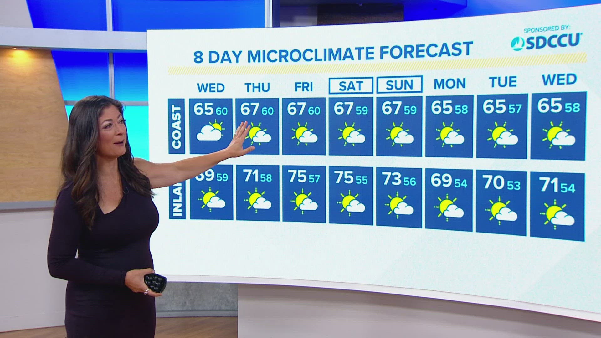
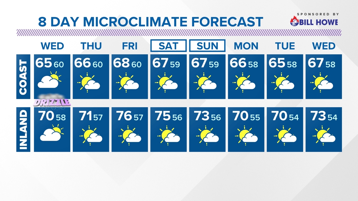
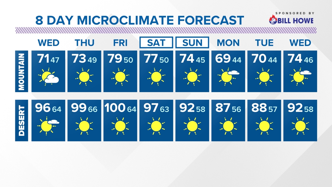
SAN DIEGO — Expect a week of mild, near seasonal conditions across San Diego County as morning clouds prevail each day, before at least partial clearing each late morning through early afternoon. Along the immediate coast, beachgoers will be hard pressed at times for the sun to peak. While some afternoons will absolutely yield some clearing, the consensus is the farther east you are, the better the opportunity for sunshine.
Wednesday will allow for cooling because of a trough of low pressure moving over the region. With a deepening of the marine layer, we could see drizzle through Wednesday morning. Temperatures will also be slightly cooler as westerly winds pick up. Widespread 60s are on tap for Wednesday afternoon with a cool breeze. The coast will remain the questionable location in terms of whether sun will prevail at any point.
SEASONAL (AVERAGE) DAYTIME HIGHS:
- Coast near 68 - 69 degrees
- Inland near 75 degrees
- Mountains near 69 degrees
- Desert near 92 degrees
WEDNESDAY TEMPERATURES:


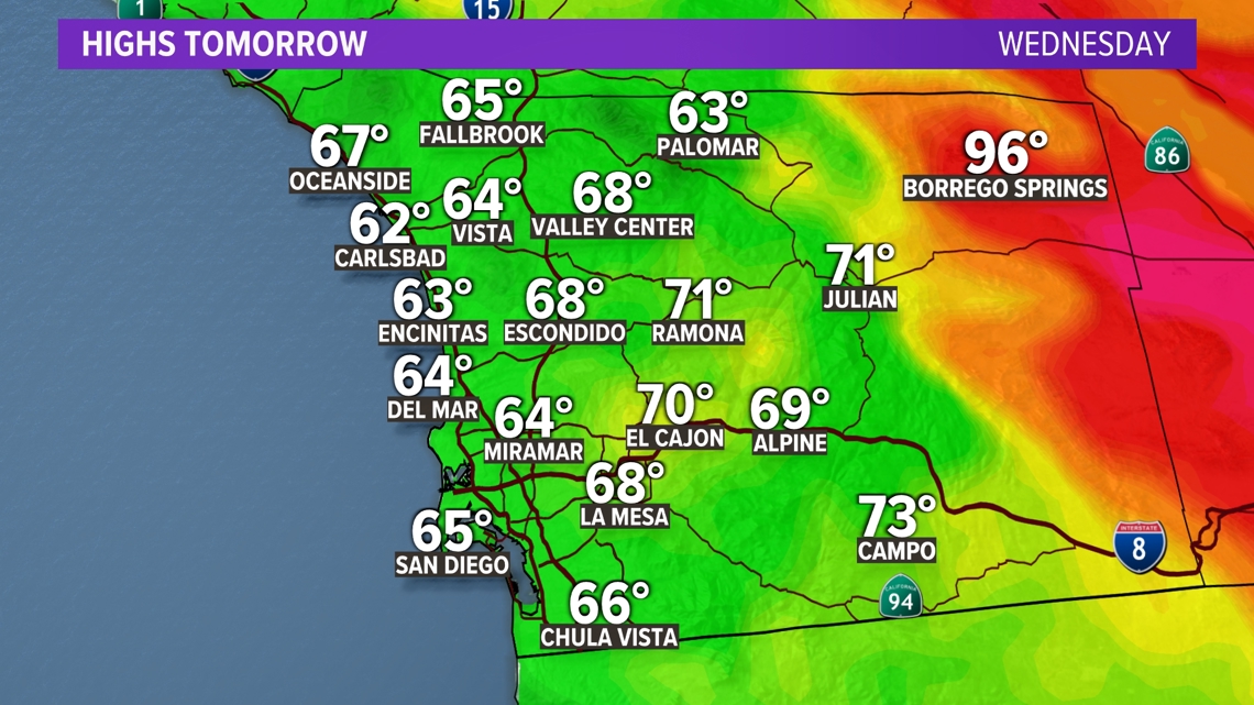
AT THE COAST:
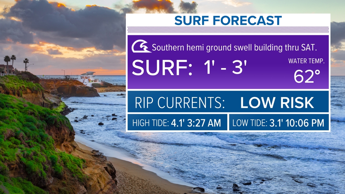
Southwest swell will remain along our coastline through Thursday. Expect the surf to be 1 to 3 feet with a low risk of rip currents during this period.


By the second half of the work week, a ridge off the Pacific will continue moving east and help to bring warmer temperatures. It will be minor, west of the mountains, with more pronounced heat for the mountains and desert. This minor blips on temps don't do much to change conditions noticeably. We will largely stay within a few degrees of normal each afternoon.
Another trough of low pressure will move in over the West and lead to a gradual cooling over the weekend and into the first half of next week.
Stay current on the microclimate forecast by downloading the CBS 8 app on your cell phone and the CBS 8+ app on Roku and Amazon Fire TV. There you’ll find all our newscasts, specials, the latest weather forecasts, breaking news, and much more.


HERE ARE MORE WAYS TO GET CBS 8:
ADD THE CBS8+ APP TO YOUR STREAMING DEVICE Roku | Amazon Fire