
SAN DIEGO — It's typical springtime weather in southern California right now. The clouds will be around in the night and early morning and part ways in the afternoon.
A dip in the jet stream will lead to a continued trough of low pressure over the West and will reinforce the repeating marine layer through the weekend. Expect the coast and Downtown San Diego to peak in the 60s with 70s across the inland valleys.
Along the immediate coast, beachgoers will be hard pressed at times to find the sun peeking from behind the clouds. While some afternoons will absolutely yield some clearing, the consensus is the farther east you are, the better the opportunity for sunshine.
The low pressure is expected to move through the region on Monday which will bring a stronger onshore flow and cooler conditions.
SEASONAL (AVERAGE) DAYTIME HIGHS:
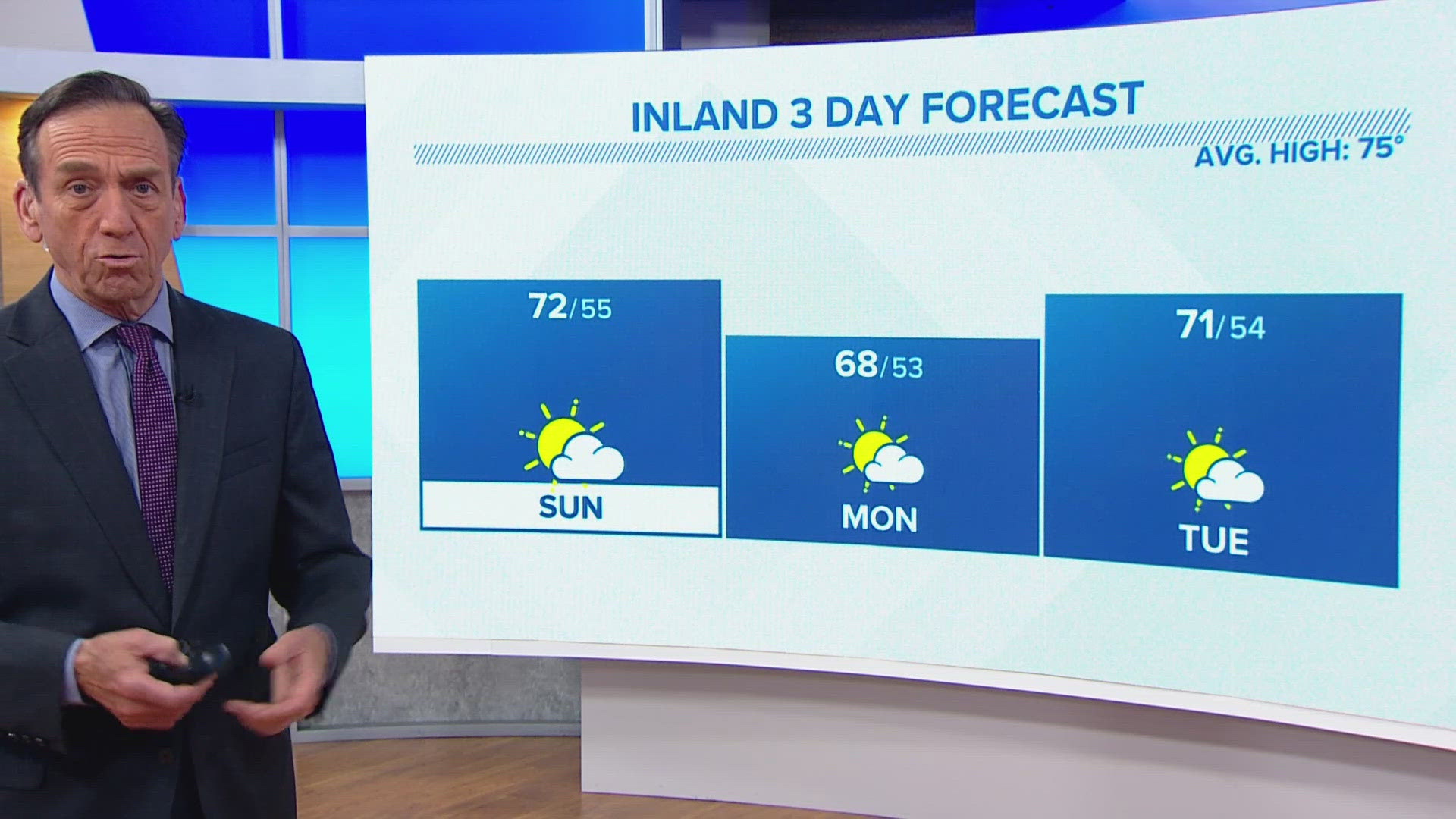
- Coast near 68 - 69 degrees
- Inland near 75 degrees
- Mountains near 69 degrees
- Desert near 93 degrees
AT THE COAST:
Surf heights will increase a little more on Sunday to 3 to 5 feet with a high risk.


By the start of next week, a weak area of low pressure will get picked up by the jet stream and move over us on Monday. This will lead to a better west breeze and cooler than usual temperatures in the widespread 60s to kick off the week. The desert will also take a hit, temperature-wise, but it still be the warmest spot in the county in the 80s.
The cooler air, gusty winds and passing clouds will be the main talkers with this system. Rain chances are less than 5%.
Stay current on the microclimate forecast by downloading the CBS 8 app on your cell phone and the CBS 8+ app on Roku and Amazon Fire TV. There you’ll find all our newscasts, specials, the latest weather forecasts, breaking news, and much more.


HERE ARE MORE WAYS TO GET CBS 8:
ADD THE CBS8+ APP TO YOUR STREAMING DEVICE Roku | Amazon Fire