
SAN DIEGO — San Diego County will be under inclement weather Friday morning and lasting into Sunday morning, with rain, wind and snow expected throughout the region, prompting the National Weather Service to post a winter weather advisory.
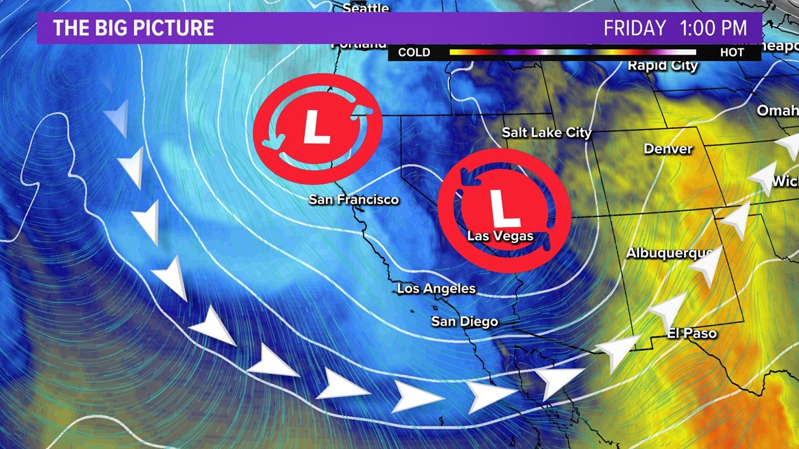
According to the NWS, a pair of low pressure systems will track over Southern California, preceded by a cold front, generating a mixed bag of atmospheric activity.
The winter weather advisory is in effect until 2 a.m. Sunday, applying to locations above 4,500 feet initially.
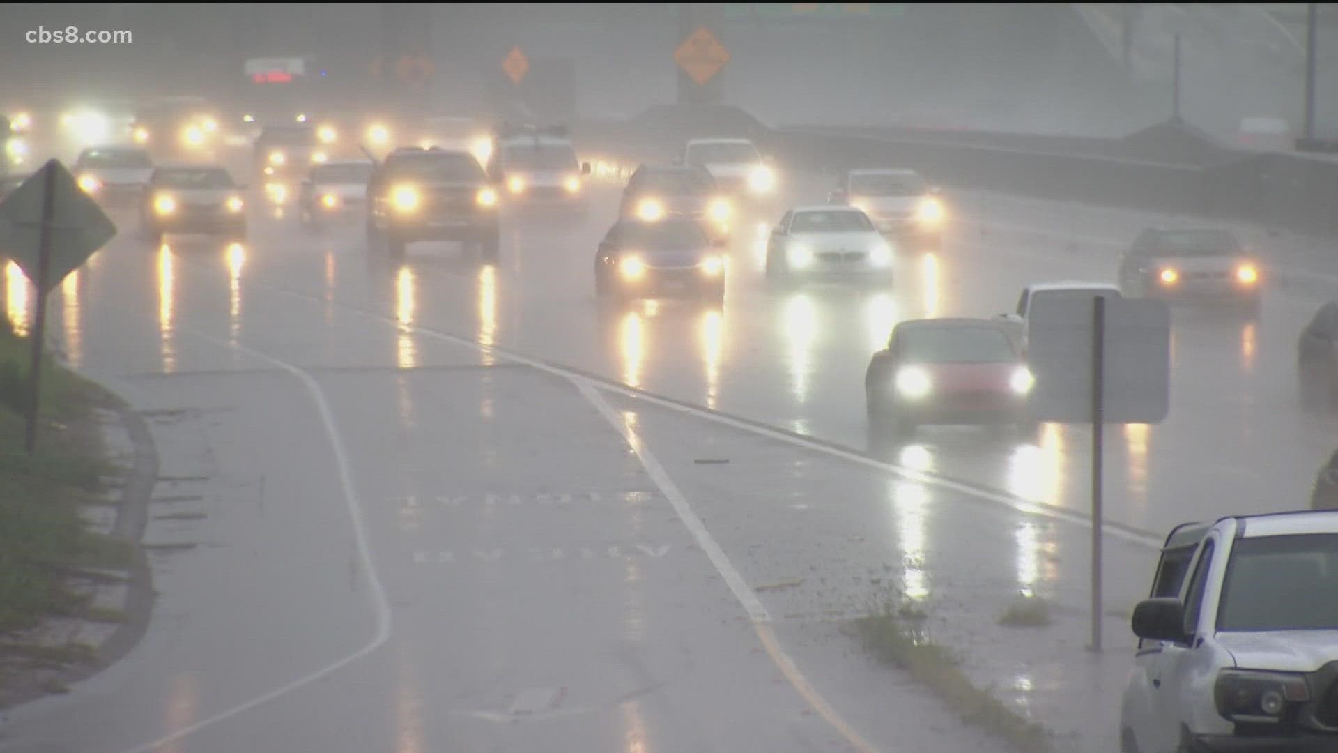
"A line of moderate showers is likely to accompany the front, along with a chance of a few thunderstorms," according to an NWS statement. "The front will sweep rapidly inland before sun-up, but cold, unstable conditions will persist over SoCal, continuing scattered showers and isolated thunderstorms through about midday Friday."
Interactive Radar Map | Follow the storm as it moves into San Diego County
The California Highway Patrol is reporting a fatality after a white Honda CR-V crashed and became trapped underneath a jack-knifed Amazon semi-truck that was blocking traffic on north Intestate 15 at the I-8 interchange.
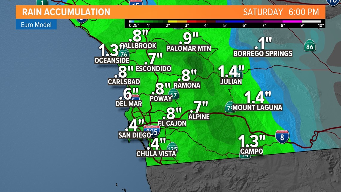
The San Diego metropolitan area is likely to receive a quarter- to a half-inch of precipitation Thursday night and Friday morning, with a tenth to a quarter-inch possible Friday afternoon and evening, meteorologists said. Another tenth of an inch is in the forecast for Saturday.
Encinitas recorded .83 inches of rain as of 2:30 a.m., according to the National Weather Service. Sylvan Meadows recorded .51 inches of rain and El Camino Del Norte recorded .42 inches of rain.
Quarry Road in Springs Valley was closed from Elkelton Place and State Route 125 because of flooding, according to the San Diego County Department of Public Works.
Flooding was also reported in lanes of Interstate 5 near the State Route 15 north exit toward Riverside.
"Snow accumulations of 8 to 14 inches above 7,500 feet, 6 to 8 inches from 6,500 feet to 7,500 feet, 4 to 6 inches from 5,500 to 6,500 feet, and 2 to 4 inches from 4,000 to 5,500 feet are expected," the NWS stated.
Winds are likely to average 25 to 35 mph as the front scoots east, with gusts as high as 60 mph in some locations, mostly mountains and passes, though the Coachella Valley will be impacted as well, forecasters said.
The next trough of low pressure will dive south from the Pacific Northwest Saturday, further lowering snow levels to 3,500 feet, according to the Weather Service.
"The inside track of this (second) storm will greatly limit valley precipitation amounts, but snowfall could still be very impactful over the mountains," the NWS said.
High temperatures in the San Diego metro area Friday are expected to hover in the near 60, with lows in the low 50s.
A warming trend will begin Monday and last through the week, along with generally dry conditions, according to the NWS.
A Winter Weather Advisory will be in effect in the San Diego County mountains from Saturday through Sunday morning, with snow levels dropping as low as 4,000 feet over the weekend. Four to eight inches of snow are possible above about 6,000 feet from late Thursday through Saturday. Up to a foot of snow is possible upwards of 7,500'. There is also a Wind Advisory in affect across San Diego County deserts until Saturday.
Conditions will shift dramatically toward wet, winter weather from late Thursday into Friday with widespread rain showers overnight along the coast that will linger through the morning and afternoon on Friday. Mountains can expect rain, snow and wind to continue from late Thursday through the weekend.
Conditions shift with a series of low-pressure troughs that sink in, and a ridge of high pressure that previously brought dry conditions, moving to the east.

The first wave of rain showers are expected to arrive with quite a bit of strength, showing an increased risk for thunderstorms along the coast and inland from about 1:00 a.m. through 4:00 a.m. on Friday morning. Light to moderate rain will continue through the morning commute and afternoon but lessen up by the evening on Friday.

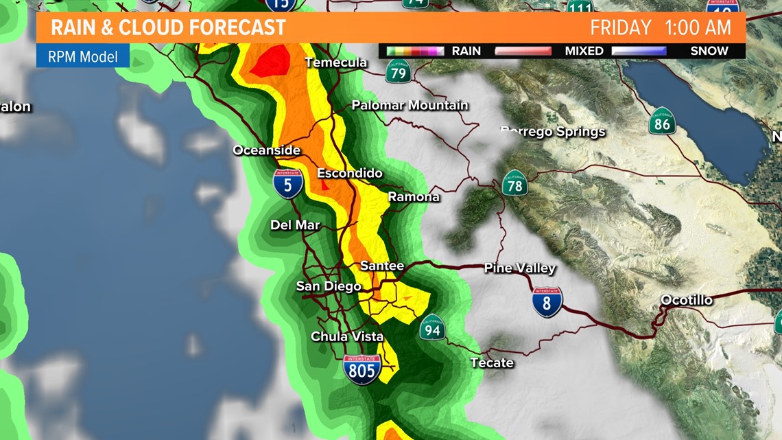

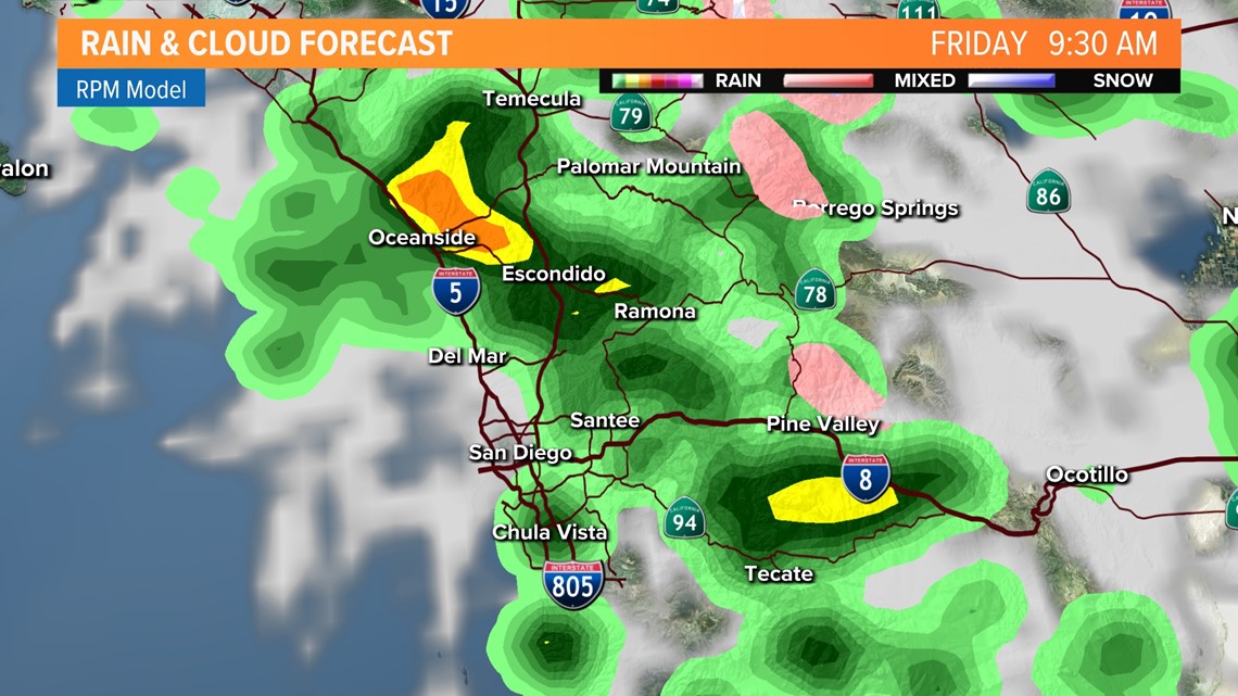
San Diego County mountains will likely receive the most precipitation during the first wave of the storm, with 1 to 1.75 inches of rain possible, while coastal and valley areas could get between a quarter-inch to an inch of rain. Desert areas will see 0.1 to 0.25 inches, forecasters said.
As the second front moves into the region Saturday, more rain will fall in mountain areas, along with another quarter-inch possible in valley areas. The snow level, meanwhile, will drop to about 3,500 feet, with "several more inches" of snow likely.

Nearly all wet weather will taper off by early Sunday. Early next week shows mostly clear and dry conditions with temperatures gradually rising through the week.
For the latest information on the forecast and the weather watches/advisories, download the News 8 app.
Watch Related: Will the snow and rain help CA drought? (Dec 31, 2021)